
Lake Effect Snow Warning: What It Means and Where It Hits Hardest
October 15, 2026
TL;DR
A lake effect snow warning is a National Weather Service (NWS) alert that heavy snow from a Great Lake is expected or already falling in a specific, often narrow area. NWS offices in New York, Ohio, and Pennsylvania issue it by that name, while Michigan offices post the same hazard as a Winter Storm Warning. Expect whiteouts and conditions that change from town to town. Stay off the roads, and keep your furnace vents clear and your filter fresh until the band moves on.
Key Takeaways
Lake effect snow forms when very cold air crosses a warmer, unfrozen Great Lake, dropping bands of heavy snow on the downwind shore.
A warning means heavy snow is expected or falling. A watch means it's possible; an advisory means a lighter event.
The alert name depends on your NWS office. Buffalo and Cleveland issue Lake Effect Snow Warnings; Grand Rapids uses Winter Storm Warnings.
Totals can differ by feet within one county, because the heaviest bands are often only 10 to 20 miles wide.
At home, a buried furnace vent is the biggest risk. Clear vents first, check the filter second, and keep CO alarms working.
What Is Lake Effect Snow?
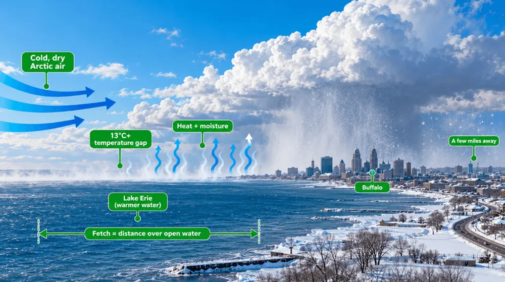
Lake effect snow is heavy, localized snow that forms when frigid air blows across a lake that is still warm and ice-free. The lake heats and moistens the air, which rises into long cloud bands that unload on the downwind shore. Forecasters look for a gap of at least 13°C (about 23°F) between the lake surface and the air roughly 5,000 feet up.
Bands are strongest with a big temperature contrast, a long fetch (distance over open water), and a steady wind. The season peaks from November through January and fades once the lakes freeze.
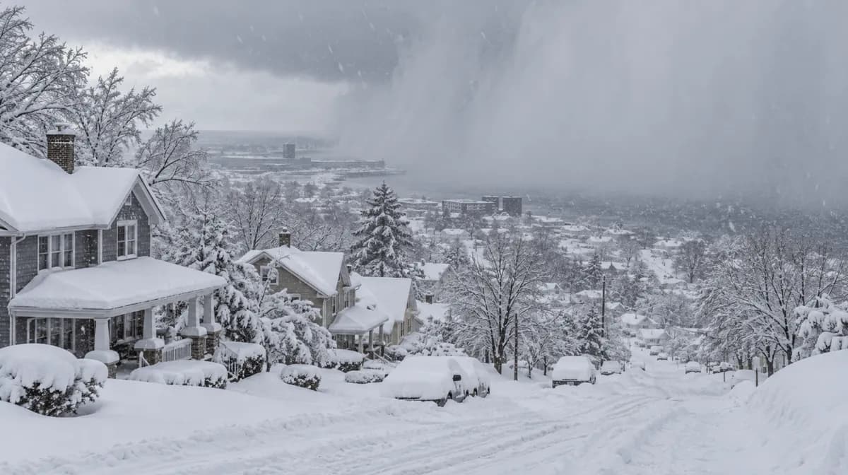
The snow lands in a tight footprint. NWS Buffalo says the most intense bands are often 10 to 20 miles wide, with rates of up to 3 inches an hour common and more than 4 in extreme cases. That's how one suburb gets 3 feet while the next town gets a dusting.
What Does a Lake Effect Snow Warning Mean?
A lake effect snow warning means the NWS expects heavy lake effect snow in a defined area soon, or it's already falling. It's one step above a watch, and conditions can turn dangerous within a few miles.
How Much Snow Triggers a Lake Effect Snow Warning?
There's no national number; each NWS office sets its own. NWS Cleveland issues one for 6 inches or more of lake effect snow, while NWS Buffalo uses 7 inches in 12 hours or 9 inches in 24 hours, according to the NWS Buffalo document cited above.
Lake Effect Snow Warning vs. Other Winter Alerts
The quickest way to read any winter alert is to match it to the action it asks of you.
Based on NWS definitions. Thresholds vary by office.
Sources: NWS Albany, NWS Wilmington, plus the NWS Cleveland and NWS Buffalo criteria cited above.
Why Your Alert May Say "Winter Storm Warning"
The alert name depends on your NWS office. Since 2017, Central Region offices, including those in Michigan, have issued lake effect events as Winter Storm Warnings, while offices in Ohio, New York, and Pennsylvania kept the Lake Effect Snow Warning. If your warning's "What" line mentions lake effect snow, the danger is the same.
How to Read the Warning Text
Three phrases in NWS warnings matter most for your home:
"In the most persistent lake snows" means the total is for the worst-hit spot; most of the county will get less.
"Snowfall rates of 2 to 3 inches per hour" is the line we watch. Many high-efficiency furnace vents sit 12 to 24 inches off the ground, so a band parked over your home can bury them in roughly 4 to 12 hours, faster with drifting.
The "When" line tells you how long your furnace will run hard and how many vent checks to plan.
To see active alerts, enter your ZIP code at weather.gov or check the NWS list of active lake effect snow warnings.
Where Do Lake Effect Snow Warnings Hit Hardest?
Lake effect snow hits hardest on the east and southeast shores of the Great Lakes, because winter winds usually blow from the west or northwest.
Sources: NWS Cleveland, NWS Buffalo, Detroit Free Press, WOOD TV8.
Buffalo shows how extreme it gets. During the November 2014 storm, more than 5 feet fell just east of the city while areas a few miles north got inches, and NWS Buffalo recorded 13 deaths and hundreds of roof collapses.
A sunny sky doesn't mean the warning missed. Warnings cover whole counties, and a wind shift can swing the band back within hours.
Is It Safe to Drive During a Lake Effect Snow Warning?
Driving during a lake effect snow warning is risky, because visibility can drop from clear to near zero in less than a mile. On December 28, 2001, a lake effect snow squall caused a 52-vehicle pileup on Interstate 80 near Loganton, Pennsylvania, that killed seven people, from less than an inch of snow.
If you must drive:
Check the NWS forecast and your state DOT road map right before leaving.
Slow down early and use low-beam headlights.
If visibility drops to near zero, exit at the next safe spot instead of stopping in a lane.
If stranded, stay with the car and clear the tailpipe before running the engine.
How to Protect Your Home During a Lake Effect Snow Warning
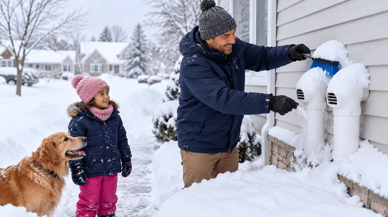
Keep your furnace's outdoor intake and exhaust vents clear. High-efficiency furnaces often vent through side-wall PVC pipes where snow drifts, and a blocked exhaust can shut off the heat or allow carbon monoxide (CO) to enter the home.
Your filter matters too. In deep cold, a furnace may run 8 to 12 hours a day, and we've seen February filters pulled completely black after 30 days.
Your Lake Effect Home Checklist
Before the snow:
Find your furnace and water heater vents, and photograph them so you can find them under drifts.
Hold your filter against white paper and replace it if it looks gray. See how often to change your air filter.
Keep a spare filter by the furnace. Deliveries stall once roads close, so order early and measure your air filter first.
Test your CO and smoke alarms.
During the warning:
Clear a 3-foot circle around each vent with a soft broom, not a shovel (New Castle County, DE).
Recheck vents every few hours and after wind shifts.
Watch for a furnace that shuts off soon after starting, new window condensation, or a CO alarm.
After the storm:
Check the filter again; we recommend checking it every 30 days all winter.
If the furnace won't restart after you clear the vents, call a licensed HVAC technician.
David Clark, Licensed HVAC Technician, put it this way in Filterbuy's winter storm warning guide: "Most no-heat calls during a winter storm trace back to two things a homeowner can check in five minutes: a snow-blocked vent pipe and a clogged filter. Clear the vents and swap the filter before the snow starts."
If a Carbon Monoxide Alarm Sounds
Get everyone outside, then call 911. CO has no color or smell, and early symptoms like headache and nausea feel like the flu. No air filter removes carbon monoxide, so clear vents and working alarms are your protection. Run generators only outdoors, at least 20 feet from doors, windows, and vents, as the CDC advises. Check on older neighbors too.
Supporting Statistics
1. Lake effect supplies up to 70%+ of snowbelt snowfall. An NSF-funded study found lake effect produced 10% to over 70% of seasonal snowfall near Lakes Erie, Michigan, and Ontario. Source: NSF Public Access Repository
2. Snowy and icy roads kill over 1,300 Americans a year. The Federal Highway Administration reports more than 1,300 deaths and 116,800 injuries annually in crashes on snowy, slushy, or icy pavement. Source: Federal Highway Administration
3. Winter brings 40% of carbon monoxide hospitalizations. A CDC analysis found winter accounted for 40% of unintentional CO hospitalizations, with the Midwest and Northeast leading from November through March. Source: CDC Stacks
Frequently Asked Questions
What should I do during a lake effect snow warning?
Avoid travel, clear your furnace and water heater vents every few hours, keep a clean filter in place, and make sure your CO alarms work.
What is the difference between a lake effect snow warning and a winter storm warning?
A lake effect snow warning covers heavy snow from a Great Lake, usually in narrow bands. A winter storm warning covers snow, sleet, or ice from any source, and some offices use it for lake effect events.
What is the difference between a lake effect snow watch and a warning?
A watch means heavy snow is possible but the timing or location is uncertain. A warning means it's expected or already happening.
Can lake effect snow cause a blizzard?
Yes. With 35 mph winds and visibility under a quarter mile for 3 hours or more, the NWS can issue a blizzard warning. In January 2014, a lake effect event brought Buffalo's first blizzard warnings since 1993 (NWS Buffalo).
Should I change my furnace filter before a lake effect storm?
Yes, if it's more than a month old or looks dirty. If you can't remember your last change, it's already overdue.
About the Author and Reviewer
Michelle Wan is Brand Manager and Air Quality Writer at Filterbuy. David Clark, a Licensed HVAC Technician with Filterbuy HVAC Solutions, reviews its HVAC guidance.
Glossary
Lake effect snow: Snow that forms when cold air crosses a warmer, unfrozen lake and picks up heat and moisture, which then fall as heavy, concentrated bands on the downwind shore.
Lake effect snow warning: A National Weather Service alert that heavy lake effect snow is expected or occurring in a localized area, issued mainly by Eastern Region offices such as Buffalo and Cleveland.
Winter storm warning: An NWS alert that heavy snow, sleet, or ice is expected or occurring. Some offices use it for lake effect snow.
Winter storm watch: An NWS alert that warning-level winter weather, including lake effect snow, is possible but not yet certain.
Winter weather advisory: An NWS alert for winter weather that will cause problems but stay below warning levels.
Blizzard warning: An NWS alert for sustained winds or frequent gusts of 35 mph or more, with snow cutting visibility to a quarter mile or less for at least 3 hours.
Snow squall: A short, intense burst of heavy snow and gusty wind that causes sudden whiteouts, usually lasting less than an hour in one spot.
Snow squall warning: A short-term NWS alert, usually 30 to 60 minutes long, for a small area in the path of a dangerous snow squall.