
Virginia Live Wildfire Smoke Map
Get Alerts For Wildfires In Your Area
The moment a wildfire starts near you, you'll get an instant alert and simple tips to reduce your smoke exposure.
What's In The Smoke
30xSmaller than a human hair
Fine enough to reach deep into the lungs. A MERV 13 is built to capture it.
How Far It Travels


It Doesn't Stay Local
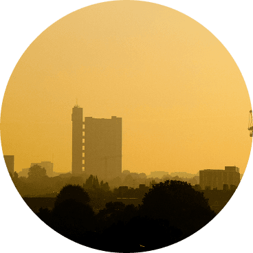
Smoke rides the wind far downwind — you can get smoky air with no fire nearby.
What To Do During A Smoke Event
Simple steps to reduce indoor exposure.
- Stay In, Close UpShut windows and doors to keep smoke out.
- Set Fan To "On"Keeps air cycling through your filter, not just when heating or cooling.
- Recirculate AirSwitch off fresh-air intake so you're not pulling smoke in.
- Run A MERV 13Built to capture the fine PM2.5 in smoke.
- Add A PurifierExtra filtration for the room you use most.
- Wear an N95 if OutsideFits snug to block fine particles — a cloth mask won't.


The Best Air Filter For Wildfire Smoke
During smoke events, the EPA recommends upgrading to a MERV 13 filter — or the highest-rated filter your system can handle — to help reduce the fine particles smoke brings indoors. MERV 13 is the level most home HVAC systems can run while still capturing PM2.5, the fine particulate that makes up the bulk of wildfire smoke.
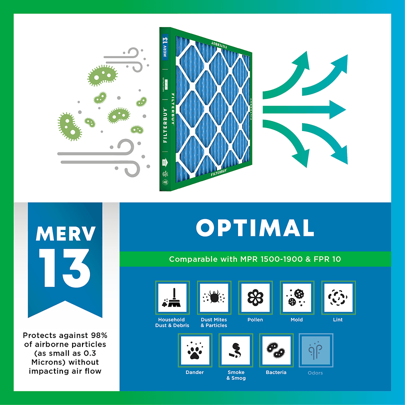
- Captures PM2.5 particles
- Blocks ash, soot, and smoke odor
- Keeps your indoor air safe—even when the outdoor air is dangerous
- Meets the EPA's recommended rating for filtering fine wildfire smoke particles.

Wildfire Smoke FAQs
Facts About Wildfires
Over 70,000 wildfires burn in the U.S. every year.
Wildfire smoke can travel 1,000+ miles, affecting states that aren't even near the blaze.
Exposure to wildfire smoke can worsen asthma, trigger heart issues, and lead to ER visits.
Indoor air can hold more fine particles during wildfire events unless it's properly filtered.
The EPA advises using MERV 13 filters or portable HEPA air cleaners during wildfire smoke events.
Don't Wait Until The Smoke's Inside.
Use the live wildfire smoke tracker and upgrade your air filters today to protect your lungs and your home.
Shop Filters For Smoke Protection
Current Live Forest Wildfire and Smoke Map Today in Virginia | Track Active Fires, Smoke Plumes, and Air Quality Warnings Impacting Your Family's Health
Author: Michelle Wan (filterbuy.com/author/michelle-wan/)
Reviewer: David Clark, Licensed HVAC Technician
Publish Date: July 13, 2026
Updated Date: July 13, 2026
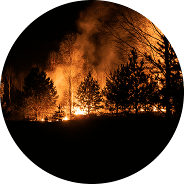
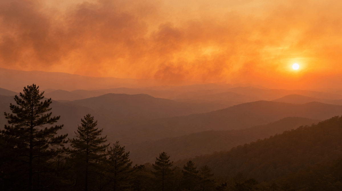
Last fall, two separate wildfires broke out in Virginia's George Washington and Jefferson National Forest, and within days a smoky haze had settled over towns fifty miles from either fire line. That is the part of fire season most homeowners do not expect. Smoke that travels in shows up long before, or long after, any flame reaches their own property line. We hear the same surprise from readers in every state where Filterbuy has built one of these live map pages, whether the smoke started three miles away or three states away. This page gives you one place to check both: the location of active fires across Virginia and the smoke and air quality data tied to them, updated for wherever you are in the Commonwealth today.
TL;DR Quick Answers
This page tracks Virginia's live wildfire and smoke conditions using the same data feeding the Virginia Department of Forestry and the EPA's AirNow Fire and Smoke Map. Virginia averages roughly 700 wildfires a year across its two official fire seasons, spring (February 15 to April 30) and fall (October 15 to November 30), and smoke from fires burning in Canada or the western United States can push local air quality into unhealthy ranges even when nothing is burning nearby. Check the live map below for your county, then use the guidance further down this page to protect your home's indoor air while conditions clear.
Key Takeaways
Virginia recorded 469 wildfires and 8,367 burned acres between January 1 and May 1, 2026, according to the Virginia Department of Emergency Management.
The Virginia Department of Forestry reports the state averages about 700 wildfires a year, with most activity concentrated in the February 15 through April 30 spring burning season.
Virginia actually runs on two official fire seasons, not one: spring (February 15 to April 30) and fall (October 15 to November 30), according to the Virginia Department of Forestry's own glossary.
Smoke does not need a local source to affect Virginia's air. Canadian wildfire smoke has driven air quality alerts across the state in past summers, and the AirNow Fire and Smoke Map tracks that smoke alongside in-state fires.
Wildfire-specific PM2.5 is linked to roughly ten times more respiratory hospital admissions than PM2.5 from other pollution sources, according to a 2021 study published in Nature Communications.
The U.S. EPA points to MERV 13 as the minimum filter rating that meaningfully reduces indoor wildfire smoke particles when an HVAC system is set to recirculate.
Virginia's statewide 4 p.m. burning law runs from February 15 through April 30 each year, and burning outside those hours during that window is a Class 3 misdemeanor.
What Is Actually Burning and Smoking Near You Right Now
The live map above draws on ground-level air monitors, temporary sensors deployed near active fires, and satellite smoke detection, the same blend of data behind the joint EPA and U.S. Forest Service Fire and Smoke Map. A wildfire, an uncontrolled fire burning in a forest, grassland, or brushland, is usually reported to Virginia authorities within minutes of ignition. The smoke plume it produces, though, often outlasts and outtravels the fire itself by days and hundreds of miles, which is why the map can show heavy smoke over your county even on a day with no active fire listed nearby.
The two fires mentioned above burned inside the George Washington and Jefferson National Forest, which posts its own current fire danger status and any active closures directly on its site whenever conditions change.
Why Wildfire Smoke Reaches Virginia Even When Virginia Is Not Burning
Roughly 80 to 90 percent of Virginia's wildfires are started by people, whether through escaped debris burns, unattended campfires, or fireworks, according to Virginia's Chief of Fire and Emergency Response. Most guides to Virginia wildfire risk stop at that one spring window, but the Commonwealth actually runs on two official fire seasons, not one. Spring fire season runs February 15 through April 30, when dead leaves and grass killed off by winter provide easy fuel, and the statewide 4 p.m. burning law is in effect. Fall fire season runs October 15 through November 30, driven by the same dry, frost-killed leaf litter piling up on the forest floor, even though it carries no statewide burning law of its own. Virginia's forestry agency publishes its own safe burning practices for anyone who plans to burn debris legally during either window. Outside both seasons, as of this page's July update, Virginia's wildfire risk drops but never disappears. Summer drought and holiday fireworks can still spark fires between the two peaks. But plenty of the smoke that shows up on Virginia's air quality monitors never started in Virginia at all. Smoke from large fires in Canada or the western United States can ride the jet stream for hundreds of miles and settle over the Commonwealth as a hazy, sometimes hazardous, layer that has nothing to do with local conditions on the ground.
How to Read the Live Map and Know When to Act
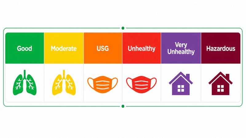
The map above color-codes air quality using the same national Air Quality Index scale that AirNow and Virginia DEQ both report. Green and yellow readings mean outdoor air is fine for most people. Orange means sensitive groups, including children, older adults, and anyone with asthma or heart disease, should start limiting outdoor exertion. Red, purple, and maroon readings mean everyone should reduce time outdoors, and maroon in particular calls for staying inside with windows and doors sealed. Check the map for your specific county rather than relying on statewide news coverage, since smoke plumes can leave one side of Virginia clear while the other side sits under a health alert.
Table 1: Air Quality Index (AQI) Category and Recommended Action
AQI ranges follow the U.S. EPA's national Air Quality Index scale used by AirNow and Virginia DEQ. Check the live map above for readings specific to your county.
Protecting Your Family's Indoor Air While You Watch the Map
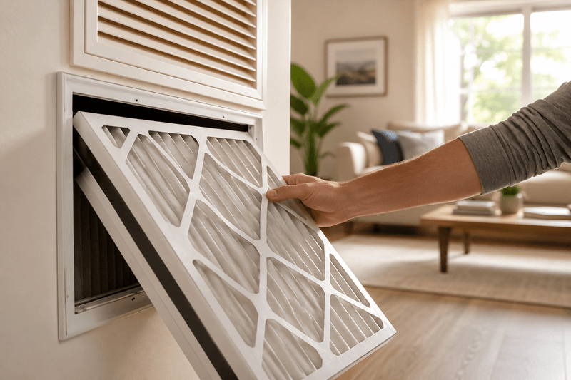
The map above tells you what is happening outside. Keeping that smoke from becoming your indoor air problem takes a few more steps. Close windows, doors, and fireplace dampers as soon as smoke is visible or the map turns orange for your county. Switch your HVAC system to recirculate mode so it stops pulling in outside air, and run it with a MERV 13 filter, the rating Filterbuy points customers toward every wildfire season without exception, and the same rating the EPA cites as the practical minimum for capturing fine wildfire smoke particles without overworking most residential blowers. A portable HEPA purifier in the room where your family sleeps adds another layer of protection during heavy smoke days. For a full room-by-room walkthrough, see our guide on how to keep wildfire smoke out of your house.
If you are not sure your ductwork can handle that jump in filtration, our breakdown of which MERV rating actually stops wildfire smoke walks through airflow and blower considerations before you buy. Central air conditioning can help on hot smoky days too, but only if it is set up correctly. See our explainer on whether your air conditioner is actually filtering that smoke for the settings that matter.
Table 2: MERV Filter Rating Comparison
Ratings reflect standard 1-inch residential filters. Confirm your HVAC system can handle MERV 13 airflow resistance before upgrading, or ask an HVAC technician to check.
After manufacturing filters for over a decade and serving more than two million households, we’ve learned that the moment smoke becomes visible outside is already too late to start looking for a MERV 13 filter. Check the map before smoke season gets bad in your area, and have a filter that can handle it already installed.
David Heacock, Founder and CEO of Filterbuy
Essential Resources
Get Real-Time Wildfire Alerts Verified by First Responders
Watch Duty, a nonprofit staffed by active and retired firefighters and dispatchers, tracks wildfire locations, red flag warnings, and evacuation orders across Virginia in real time and pushes verified alerts straight to your phone.
Source: Watch Duty Real-Time Wildfire Tracking
See Today's Statewide Fire Danger Rating From Virginia's Own Forestry Agency
The Virginia Department of Forestry publishes a daily readiness class rating for every part of the state, which is the same data its own fire crews use to gauge how quickly a new fire could spread.
Source: Virginia Department of Forestry Daily Fire Danger Rating
Track Virginia's Official Ozone and Particle Pollution Forecast
Virginia DEQ issues its own daily air quality forecast by region, covering Northern Virginia, Richmond, Hampton Roads, Roanoke, and Winchester separately, and will send free email alerts when conditions turn unhealthy.
Source: Virginia DEQ Air Quality Forecast
Learn How Wildfire Smoke Gets Into Your House and How to Stop It
The EPA's dedicated wildfire indoor air quality page walks through exactly how smoke infiltrates a home through vents, gaps, and mechanical ventilation, along with the agency's protective recommendations.
Source: EPA Wildfires and Indoor Air Quality
Get Neighborhood-Level Wildfire Preparedness Guidance
The National Fire Protection Association's Firewise USA program shows homeowners and neighborhoods how to create defensible space and reduce wildfire risk around their property, the same approach fire-prone communities across Virginia can use during fire season peaks.
Source: NFPA Firewise USA
Review Federal Health Guidance for Smoke-Sensitive Groups
The CDC's wildfire safety guidelines cover specific precautions for children, older adults, and people with asthma, COPD, heart disease, or diabetes during a smoke event.
Source: CDC Safety Guidelines for Wildfires and Wildfire Smoke
See the National Picture of Active Fires Feeding Virginia's Skies
The National Interagency Fire Center's daily fire news report shows how much of the country is currently burning, useful context for understanding where drift smoke over Virginia might be coming from.
Source: NIFC National Fire News
Supporting Statistics
Wildfire Smoke Is Driving More Air Quality Failures Nationwide
The American Lung Association's 2026 State of the Air report ties worsening air quality directly to wildfire smoke.
44 percent of people in the United States, about 152.3 million people, live in places with a failing grade for unhealthy ozone or particle pollution.
Wildfire smoke is named as a growing driver of that failing grade.
Source: American Lung Association State of the Air Key Findings
Nationwide Data Backs Up Virginia's Own Numbers on Human-Caused Fires
The Congressional Research Service confirms that people, not lightning, start most U.S. wildfires.
89 percent of the average number of U.S. wildfires from 2018 to 2022 were human-caused.
That figure closely matches Virginia's own 80 to 90 percent estimate for the Commonwealth.
Debris burns, campfires, and equipment sparks lead the causes, ahead of lightning.
Source: Congressional Research Service, Wildfire Statistics (Congress.gov)
Wildfire Smoke Hits the Lungs Harder Than Ordinary Air Pollution
A 2021 study in Nature Communications found wildfire smoke carries an outsized health cost.
PM2.5 from wildfire smoke was linked to a substantially larger increase in respiratory hospital admissions than PM2.5 from other pollution sources.
The gap held even after researchers isolated wildfire smoke from other causes of particle pollution.
Source: Aguilera et al., 2021, Nature Communications
Final Thoughts and Opinion
Virginia will probably never see the mega-fires that make national news out west, and that is exactly why so many Virginians get caught off guard by smoke that rolled in from somewhere else. At Filterbuy, we think of this as Virginia's two-source smoke problem: a small, mostly human-caused fire season at home, layered on top of drift smoke that can arrive from a fire hundreds of miles away with no local warning at all. A live map only helps if you actually check it before the sky looks hazy, not after. Build the habit now, keep a MERV 13 filter on hand before fire season peaks, and you will spend far less time scrambling once smoke actually shows up over your address.
Next Steps
Bookmark this page and check the live map at the top whenever the sky looks hazy or a red flag warning is issued for your area. If smoke is already affecting your home, read our guide on the long-term health effects of wildfire smoke exposure for a fuller room-by-room protection plan.
Frequently Asked Questions
Check The Live Map Now
Check the live map above right now for your Virginia county. If conditions are already smoky, set your HVAC system to recirculate and install a Filterbuy MERV 13 air filter before you do anything else.
Glossary
Air Quality Index (AQI): A national scale, color-coded from green to maroon, that the EPA and state agencies use to report how clean or polluted outdoor air is on a given day.
PM2.5: Fine particulate matter measuring 2.5 micrometers or smaller in diameter, the main harmful pollutant in wildfire smoke and small enough to reach deep into the lungs.
MERV Rating: Minimum Efficiency Reporting Value, a 1 through 16 scale that measures how effectively an air filter captures airborne particles, with higher numbers capturing smaller particles.
HEPA Filter: High Efficiency Particulate Air filter, a filtration standard capable of capturing at least 99.97 percent of particles 0.3 microns in size, typically used in portable air purifiers rather than standard HVAC duct slots.
AirNow Fire and Smoke Map: An interactive online map, jointly developed by the EPA and U.S. Forest Service, that displays fire locations, smoke plumes, and near real-time air quality readings across North America.
Virginia Department of Forestry (DOF): The state agency responsible for monitoring wildfire risk, issuing daily fire danger ratings, and coordinating wildfire suppression across the Commonwealth.
Smoke Plume: A visible column or layer of smoke and particulate matter released by a fire, which can travel far beyond the fire's actual footprint depending on wind and weather.
Recirculate Mode: An HVAC fan setting that cycles indoor air repeatedly through the system's filter instead of drawing in fresh air from outside, useful for limiting smoke infiltration.
Burn Ban: A local or statewide restriction, sometimes tied to Virginia's 4 p.m. burning law, that prohibits outdoor burning during periods of elevated fire danger.
Fire Season: The Virginia Department of Forestry's term for the two annual windows when wildfires are most likely, spring (February 15 to April 30) and fall (October 15 to November 30), driven by dry, dead vegetation on the forest floor.
Subscribe to wildfire smoke alerts for Virginia to get a heads-up before the next event reaches your area.