
El Paso, TX Live Wildfire Smoke Map
Get Alerts For Wildfires In Your Area
The moment a wildfire starts near you, you'll get an instant alert and simple tips to reduce your smoke exposure.
What's In The Smoke
30xSmaller than a human hair
Fine enough to reach deep into the lungs. A MERV 13 is built to capture it.
How Far It Travels


It Doesn't Stay Local
Smoke rides the wind far downwind — you can get smoky air with no fire nearby.
What To Do During A Smoke Event
Simple steps to reduce indoor exposure.
- Stay In, Close UpShut windows and doors to keep smoke out.
- Set Fan To "On"Keeps air cycling through your filter, not just when heating or cooling.
- Recirculate AirSwitch off fresh-air intake so you're not pulling smoke in.
- Run A MERV 13Built to capture the fine PM2.5 in smoke.
- Add A PurifierExtra filtration for the room you use most.
- Wear an N95 if OutsideFits snug to block fine particles — a cloth mask won't.


The Best Air Filter For Wildfire Smoke
During smoke events, the EPA recommends upgrading to a MERV 13 filter — or the highest-rated filter your system can handle — to help reduce the fine particles smoke brings indoors. MERV 13 is the level most home HVAC systems can run while still capturing PM2.5, the fine particulate that makes up the bulk of wildfire smoke.
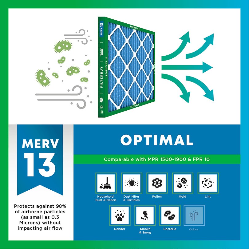

- Captures PM2.5 particles
- Blocks ash, soot, and smoke odor
- Keeps your indoor air safe—even when the outdoor air is dangerous
- Meets the EPA's recommended rating for filtering fine wildfire smoke particles.

Wildfire Smoke FAQs
Facts About Wildfires
Over 70,000 wildfires burn in the U.S. every year.
Wildfire smoke can travel 1,000+ miles, affecting states that aren't even near the blaze.
Exposure to wildfire smoke can worsen asthma, trigger heart issues, and lead to ER visits.
Indoor air can hold more fine particles during wildfire events unless it's properly filtered.
The EPA advises using MERV 13 filters or portable HEPA air cleaners during wildfire smoke events.
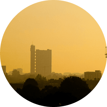
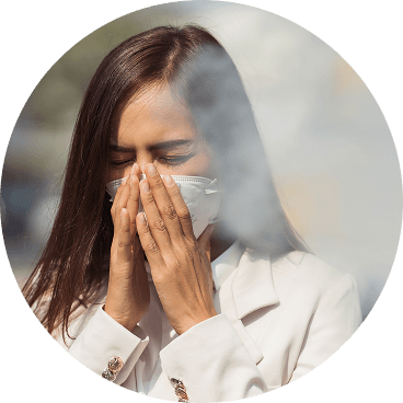
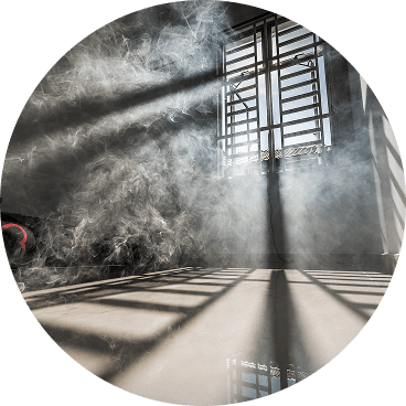
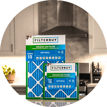
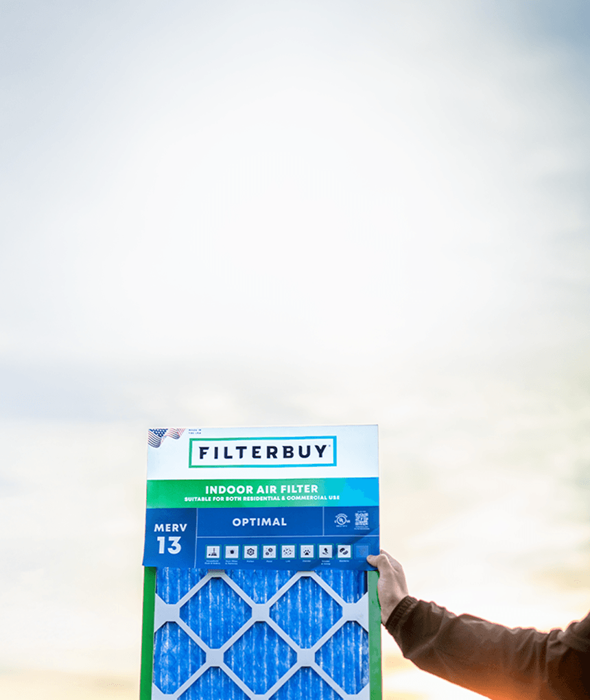
Don't Wait Until The Smoke's Inside.
Use the live wildfire smoke tracker and upgrade your air filters today to protect your lungs and your home.
Shop Filters For Smoke Protection
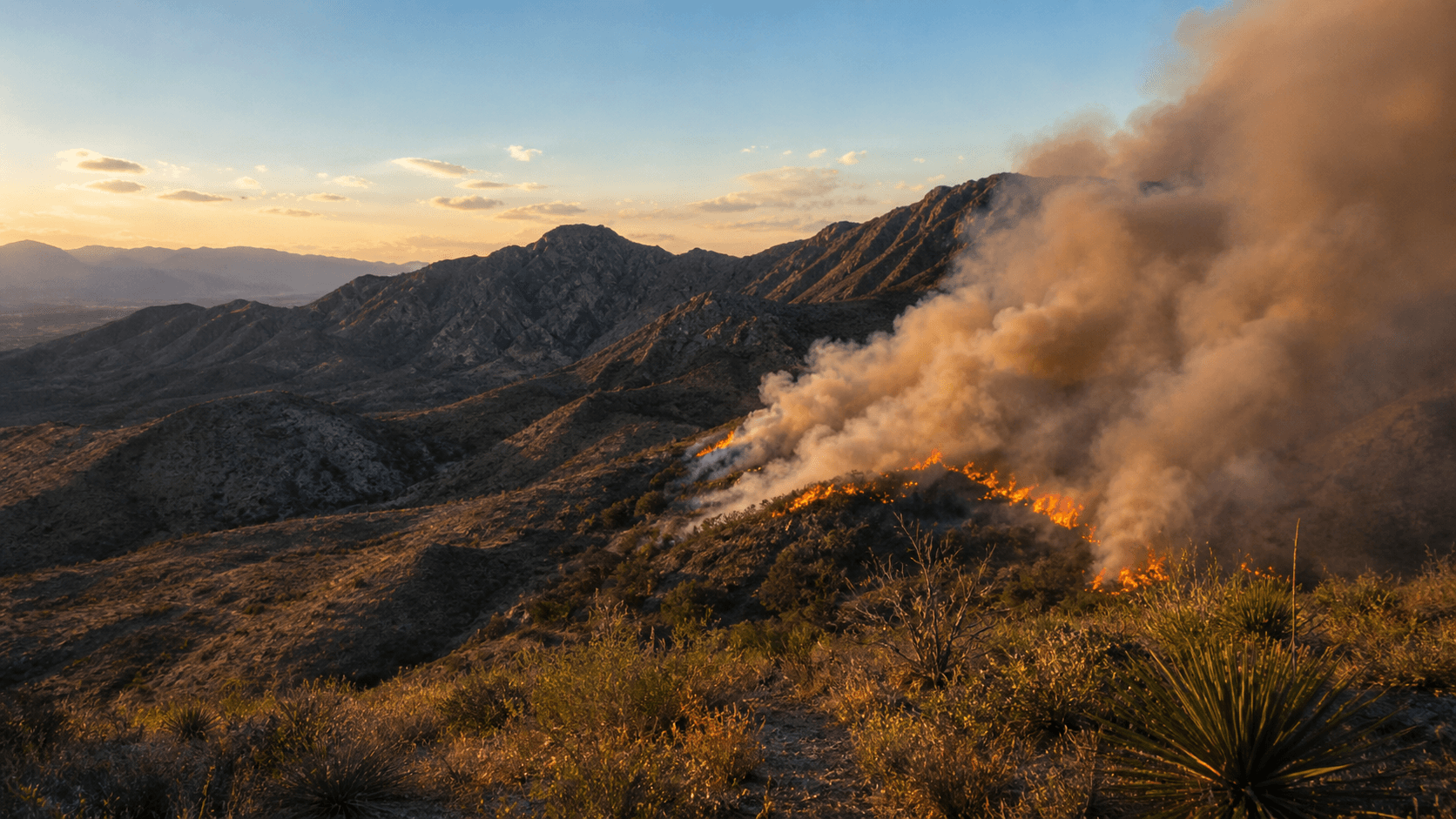
Is Your Family at Risk? Current Live Forest Wildfire and Smoke Map Today in El Paso, TX
Track Fires & Evacuations
Wildfire smoke is the air quality threat that El Paso families almost always learn about too late. Most homes catch it on the windshield or in a kid's coughing fit, well after indoor PM2.5 has already started climbing inside the bedrooms where the family sleeps. We built this page to close that gap. The live map above pulls active fires from the Lincoln National Forest, the Trans-Pecos grasslands, and the northern Chihuahua agricultural belt, and layers them with smoke plume forecasts so you can see what is heading toward your address before it lands.
TL;DR Quick Answers
Current Live Forest Wildfire and Smoke Map Today in El Paso, TX
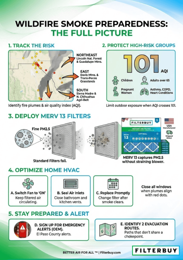
The live map on this page pulls active wildfire perimeters and PM2.5 smoke plumes for the El Paso area in real time, refreshed every few minutes from federal incident feeds and crowdsourced air quality sensors. Smoke around the Borderland typically arrives from three corridors — the Lincoln National Forest to the northeast, the Trans-Pecos grasslands to the east, and the northern Chihuahua agricultural belt to the south. The action threshold is a dark gray plume sitting over orange or red sensor dots near your address. When you hit it, close the windows and switch your HVAC fan from Auto to On until the wind clears.
Top Takeaways
El Paso sits at the intersection of three regional fire corridors: the Lincoln National Forest and Guadalupe range to the northeast, the Trans-Pecos grasslands to the east, and the Sierra Madre and northern Chihuahua to the south.
On the map, the smoke plume layer matters more than the fire icon when the wind is blowing in your direction. A dark gray plume sitting over orange or red sensor dots is the combination that calls for action.
Indoor PM2.5 starts climbing within hours of an outdoor smoke event arriving, even with windows closed. Preparation done before the smoke hits is what protects family health, not reaction during the event.
MERV 8 filters miss most wildfire PM2.5. A correctly sized MERV 13 captures a far higher share of those fine particles without straining a properly sized residential blower.
Children, adults over 65, pregnant women, and anyone with asthma, COPD, or heart disease are the high-risk groups whenever smoke arrives over the city.
Verify evacuation routes through official El Paso County channels rather than social media. A wildfire can shift direction within a single afternoon when the wind turns.
Current Active Wildfires Near El Paso and Across the Borderland
We have shipped filters into West Texas long enough to know the Borderland fire season has its own geography. Most current fires near El Paso start in one of three corridors. The Lincoln National Forest and Guadalupe Mountains push smoke down from the northeast. The Davis Mountains and Trans-Pecos grasslands feed it from the east. And cross-border smoke from northern Chihuahua agricultural fires arrives from the south, which is the source most national trackers miss and which is part of why a Texas forest fire map today reading often understates what El Paso households are actually breathing.
When the National Interagency Fire Center elevates the Southwest Geographic Area to a higher preparedness level, the Borderland tends to feel it within the same week. The map above is a Texas wildfire smoke tracker built on federal incident feeds and PM2.5 readings from regulatory monitors and PurpleAir sensors, so you are seeing both where the flames are and where the smoke has already arrived.
How to Read the El Paso Smoke Map Today
Two visual layers sit on top of each other. The first is the smoke plume layer, drawn in thin gray bands that darken with density. Light gray bands are thin, high-altitude smoke — mostly a sky tint, more of a view problem than a health one. The mid-tones drop the smoke down to surface level, where sensitive groups start feeling it. The layer to take seriously is dark gray, because that density usually means the AQI has already tipped into Unhealthy or worse. Sitting underneath the plume layer is the dot grid of air quality sensors, color-coded from green to maroon. When you spot a cluster of orange or red dots inside a dark gray plume near your address, the smoke conditions in El Paso, Texas, live readers want to track for safety have arrived.
The National Weather Service El Paso forecast office tracks the wind patterns moving that smoke. Prevailing southwesterlies funnel plumes from the Guadalupe range straight down the Hueco Bolson into the urban core. Fronts pull Sierra Madre smoke up across the bridges from the south. Knowing which way the wind is blowing tells you whether the next 12 hours will clear the air or worsen it.
El Paso AQI Smoke Levels: What They Mean for Your Family
The EPA Air Quality Index runs from 0 to 500 across six bands. Anything from 0 to 50 reads as Good, and 51 to 100 as Moderate. Cross into the 101 to 150 range, and you're in Unhealthy for Sensitive Groups territory, which means children, adults over 65, pregnant women, and anyone with asthma, COPD, or heart disease should start cutting back on outdoor exposure. Above 150, the air is Unhealthy for everyone. From 201 to 300, it climbs to Very Unhealthy, and Hazardous starts at 301.
Wildfire smoke pushes those numbers up fast because the dominant pollutant is PM2.5, particles small enough to bypass the nose and throat and lodge deep in lung tissue. The American Lung Association has flagged Texas as one of the states where short-term particle pollution worsened in the most recent State of the Air report, and El Paso County sits in the bullseye whenever smoke from the west or south arrives.
For sensor-by-sensor readings beyond the smoke layer, check the current AQI in El Paso, Texas, before deciding whether outdoor activities are safe today.
Protecting Your Indoor Air When Smoke Reaches the City
Most families are not ready for what happens next. Indoor PM2.5 starts climbing fast once a smoke plume settles over the city, even with windows shut and exterior doors closed. The smoke pulls in through bathroom vents, recessed lighting, electrical outlets, and any HVAC system running on its default Auto setting with a standard filter. After manufacturing filters for over a decade and serving more than two million households, we have watched the same pattern repeat in every smoke-prone region we ship into. The homes that stay clean during a fire event are the ones that have prepared their HVAC system before the smoke hits.
A MERV 8 filter, which is what most central HVAC systems ship with from the builder, lets the majority of wildfire PM2.5 pass right through the system and back into the room. Swap that for a MERV 13 filter built to the same outer dimensions, and you capture a far higher share of those fine particles, without straining a properly sized residential blower. Run the fan on the On setting instead of Auto so the filtered air keeps circulating throughout the duration of the event. Change the filter immediately after the smoke clears because it will be loaded, and consider a portable air cleaner with a HEPA filter for the bedroom where your most sensitive family member sleeps.
Wildfire Updates: El Paso, TX Residents Can Act On
A wildfire can shift direction in minutes when the wind turns, so verify your route through official channels before you move. Sign up for El Paso County emergency alerts through the county Office of Emergency Management. Save the National Weather Service El Paso forecast page on your phone's browser. Identify two evacuation routes out of your neighborhood that do not share a single chokepoint, and make sure every adult in the household knows both. If authorities ask you to shelter in place, close every window, switch the HVAC fan on, and move to your interior room with the cleanest air.
"When wildfire smoke from the Lincoln National Forest or northern Chihuahua reaches El Paso, the indoor air your family is breathing changes within hours, not days. The fastest protection most households can put in place today is a MERV 13 filter sized correctly for their system, run on the fan-on setting through the duration of the smoke event. I have watched households in West Texas and along the New Mexico line cut their indoor particle counts dramatically with that single change. The bedroom air your kids are breathing tonight is the air you actually have control over, even when you cannot do anything about what is happening on the mountain."
— Filterbuy Team
Essential Resources for El Paso Wildfire and Smoke Tracking
We pulled the resources below from federal agencies, state authorities, and national health nonprofits with documented track records on wildfire and air quality. Use them when you want to verify what you are seeing on the live map or pull deeper guidance for a specific situation in your household.
The joint EPA and U.S. Forest Service map that powers most of what you see above. Combines fire perimeters, smoke plume forecasts, and real-time PM2.5 readings from regulatory and PurpleAir sensors in a single view.
Source: AirNow Fire and Smoke Map
The state-level dashboard for active fires that Texas A&M Forest Service personnel are responding to. Shows preparedness level, recent activity, and which counties have burn bans in effect.
Source: Texas A&M Forest Service Current Wildfire Status
The interagency platform where federal incident management teams post evacuation orders, road closures, maps, and twice-daily updates on every named wildfire in the country.
Source: InciWeb Incident Information System
Local wind, dispersion, red flag warnings, and the area forecast discussion. Bookmark this for the wind direction call that tells you whether smoke is about to clear or thicken over the city.
Source: National Weather Service El Paso Forecast Office
Federal public health guidance on how to set up a cleaner air room, when to wear an N95 respirator, and which family members face the highest risk during a smoke event.
Source: CDC Safety Guidelines for Wildfires and Wildfire Smoke
The agency's residential guide to how smoke gets indoors, which HVAC and portable air cleaner strategies actually work, and how to prepare your home before fire season.
Source: EPA Wildfires and Indoor Air Quality
The annual national report card on ozone and particle pollution. Useful for tracking how El Paso, the surrounding Texas counties, and the broader Southwest are trending year over year.
Source: American Lung Association State of the Air
Statistics That Put El Paso Wildfire Smoke in Context
The three statistics below put a number on what El Paso families already feel during a smoke week. Each one comes from a different federal agency or national health nonprofit, so you can see how the local picture connects to what is happening across the state and the country.
64,897 wildfires burned 8,924,884 acres across the United States in 2024, both above the five and ten-year averages. That figure is why smoke days have shifted from a rare event to a recurring planning item for El Paso families.
Source: National Interagency Fire Center Wildland Fire Statistics
44 percent of Americans, 152.3 million people, live in places with failing grades for unhealthy levels of ozone or particle pollution. Texas is one of the states where short-term particle pollution worsened in the most recent reporting period, which directly affects what El Paso households breathe during smoke events.
Source: American Lung Association State of the Air Key Findings
Short-term PM2.5 exposure from wildfire smoke can range from minor eye and respiratory irritation to exacerbation of asthma, heart failure, and premature death. The EPA classifies these effects as well-supported by the scientific literature on wildfire-specific PM2.5 exposure, which is why the AQI threshold for sensitive groups starts at 101.
Source: EPA Health Effects Attributed to Wildfire Smoke
Final Thoughts and Opinion
El Paso families know dust. Anyone raised in the Borderland learned the haboob routine before they could drive — when the sky goes orange, you close the windows and put the microfiber cloth by the door. Wildfire smoke requires a different reflex, because it does not look like a dust storm and does not pass on the same timeline. We are obsessed with indoor air quality for a living, and the pattern we keep seeing is the same one across every smoke-prone region we ship into. The households that stay healthy during a smoke-free week are the ones that treat their indoor air as the variable they can actually control. The fire on the mountain is going to do what fires do, and the wind is going to do what the wind does. The filter in your return air grille, though, is yours.
Next Steps
If smoke is in El Paso right now, work through this list in order.
Open the live wildfire and smoke map on this page and identify the closest active fire, then check whether the wind is moving smoke toward your address.
Sign up for El Paso County emergency alerts through the Office of Emergency Management so evacuation orders reach your phone the moment they go out.
Close every window and exterior door, switch the HVAC fan from Auto to On, and turn off any device that pulls in outdoor air, including bathroom and kitchen vents you are not actively using.
Check the MERV rating on your current HVAC filter. If it is below MERV 13, plan to upgrade before the next event and order a correctly sized replacement today.
Set up a cleaner air room for sleep, ideally an interior bedroom with a portable air cleaner sized for the square footage and a closed door for the duration of the event.
Identify two evacuation routes out of your neighborhood that do not share a single chokepoint, and confirm every adult in the household knows both.
Once the smoke clears, replace the HVAC filter immediately and run the fan for an additional hour to flush the system.
Frequently Asked Questions
Smoke does not wait for shipping windows. The next time the wind shifts, the protection your family is breathing through should already be in your filter slot, not on a delivery truck. Find the right MERV 13 filter for your system at Filterbuy, manufactured in the USA and shipped directly from our factory, so you are ready before the next plume arrives over the Borderland.