
Austin, TX Live Wildfire Smoke Map
Get Alerts For Wildfires In Your Area
The moment a wildfire starts near you, you'll get an instant alert and simple tips to reduce your smoke exposure.
What's In The Smoke
30xSmaller than a human hair
Fine enough to reach deep into the lungs. A MERV 13 is built to capture it.
How Far It Travels


It Doesn't Stay Local
Smoke rides the wind far downwind — you can get smoky air with no fire nearby.
What To Do During A Smoke Event
Simple steps to reduce indoor exposure.
- Stay In, Close UpShut windows and doors to keep smoke out.
- Set Fan To "On"Keeps air cycling through your filter, not just when heating or cooling.
- Recirculate AirSwitch off fresh-air intake so you're not pulling smoke in.
- Run A MERV 13Built to capture the fine PM2.5 in smoke.
- Add A PurifierExtra filtration for the room you use most.
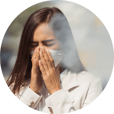
- Wear an N95 if OutsideFits snug to block fine particles — a cloth mask won't.


The Best Air Filter For Wildfire Smoke
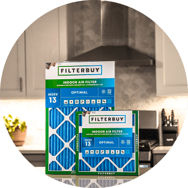
During smoke events, the EPA recommends upgrading to a MERV 13 filter — or the highest-rated filter your system can handle — to help reduce the fine particles smoke brings indoors. MERV 13 is the level most home HVAC systems can run while still capturing PM2.5, the fine particulate that makes up the bulk of wildfire smoke.
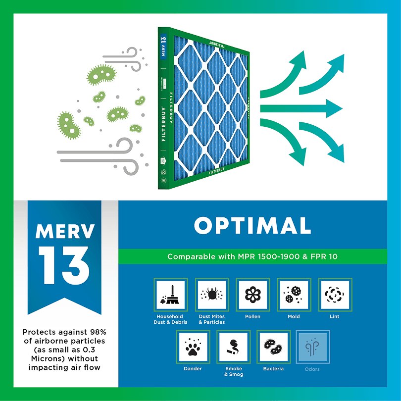

- Captures PM2.5 particles
- Blocks ash, soot, and smoke odor
- Keeps your indoor air safe—even when the outdoor air is dangerous
- Meets the EPA's recommended rating for filtering fine wildfire smoke particles.

Wildfire Smoke FAQs
Facts About Wildfires
Over 70,000 wildfires burn in the U.S. every year.
Wildfire smoke can travel 1,000+ miles, affecting states that aren't even near the blaze.
Exposure to wildfire smoke can worsen asthma, trigger heart issues, and lead to ER visits.
Indoor air can hold more fine particles during wildfire events unless it's properly filtered.
The EPA advises using MERV 13 filters or portable HEPA air cleaners during wildfire smoke events.
Don't Wait Until The Smoke's Inside.
Use the live wildfire smoke tracker and upgrade your air filters today to protect your lungs and your home.
Shop Filters For Smoke Protection
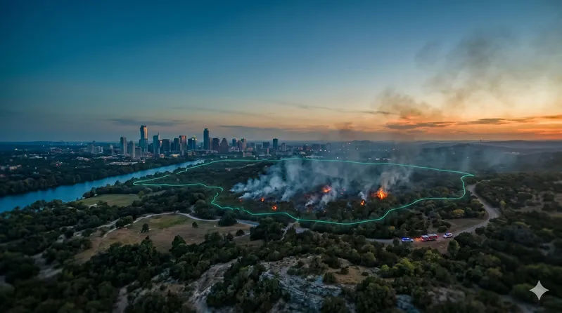
Should You Evacuate? Current Live Forest Wildfire and Smoke Map Today in Austin, TX | Real-Time Fire Tracking & Safety Alerts
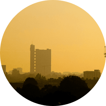
A gray-brown haze settling over Lake Travis is not morning fog. When fire burns across the Texas Hill Country or the Western Plains, smoke reaches Central Texas faster than most families realize, often well before the smell is strong enough to raise an alarm. By the time an Austin resident notices the sky has gone flat and orange, outdoor air can already be measuring at levels the EPA classifies as harmful to sensitive groups.
The live fire map and AQI data on this page draw from the same federal and state sources incident commanders use during active Texas wildfires: InciWeb, the U.S. Forest Service active fire layer, and EPA monitoring stations the TCEQ operates across Travis and Williamson Counties. The fire map shows where smoke is being produced; the AQI number shows what has already reached your air. Both change fast when conditions are active, and knowing both together is what turns a wireless alert into a real decision — seal the house, pull the kids in, switch your HVAC to recirculate, or start thinking about when to leave.
TL;DR Quick Answers
Track active wildfires near Austin, TX and current smoke coverage using the live map on this page, powered by InciWeb and USFS fire data. Check the Austin air quality index now at airnow.gov — AQI above 101 is Unhealthy for Sensitive Groups. If smoke is present, switch your HVAC to recirculate mode and install a MERV 13 filter to protect indoor air quality.
Top Takeaways
The live Austin, TX wildfire map pulls real-time fire perimeter data from InciWeb and USFS satellite detection, covering all active wildfires that may affect Travis County and surrounding areas.
Wildfire smoke can reach the Austin metro from fires 100 or more miles away within three to six hours under normal wind conditions.
AQI readings above 101 on the Austin TX AQI live tracker signal unhealthy air for sensitive groups, including children, older adults, and anyone with a respiratory or cardiovascular condition.
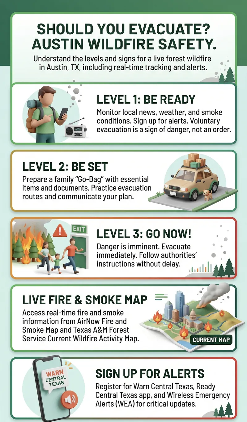
Travis County evacuation orders and Texas wildfire air quality alerts flow through separate systems: WarnCentralTexas.org for evacuation, EPA AirNow and TCEQ for smoke.
A MERV 13 filter and indoor HVAC recirculation mode are the two most effective household defenses against wildfire smoke PM2.5 infiltration.
Smoke from active wildfires near Austin can linger for days after a fire is contained, making the smoke map Texas today worth checking well beyond the initial event.
What the Austin, TX Wildfire Map Is Showing Right Now
The live wildfire map on this page pulls fire perimeter data from InciWeb, the federal interagency incident information system maintained by the National Wildfire Coordinating Group, and from the U.S. Forest Service active fire layer. Each perimeter reflects the most recently reported boundary of a confirmed wildfire, including fires burning in the Texas Hill Country, Bastrop County, the Llano Estacado, and the Trans-Pecos region that push smoke east and southeast into the Austin metro area.
Fire perimeters update as containment reports come in from incident commanders on the ground. Between official updates, satellite hotspot detection from NASA MODIS and VIIRS instruments fills the gaps, giving you a near-real-time picture of where active burning is occurring. The Texas A&M Forest Service maintains a parallel live incident viewer specific to Texas wildfires. Together, these sources give you the same situational picture that Texas wildland fire crews use in the field.
How Wildfire Smoke Reaches Austin — And How Fast
Austin sits at a geographic crossroads for wildfire smoke. Fires burning to the west and northwest in the Hill Country and Edwards Plateau can deliver heavy smoke in a matter of hours when southwesterly winds align with the I-35 corridor. Fires in the Texas Panhandle and Southern Plains move smoke southeast, often arriving overnight as cold fronts push through. Large fires burning in New Mexico and West Texas regularly affect Central Texas air quality. The plumes don't stop at the state line.
Smoke plumes travel at wind speed, not fire spread speed. A fire 100 miles from downtown Austin can degrade the AQI in Travis County within three to six hours under the right atmospheric conditions. The smoke map Texas today shows active plumes overlaid on fire locations, giving you both the source and the current drift direction. That second layer — the smoke plume data — tells you something the fire map alone cannot: whether the air in your part of Austin has already been reached.
Austin AQI Live — Reading the Air Quality Index
The Air Quality Index runs from 0 to 500, and the number that matters most for Austin households during wildfire season is 101. Below 100, air quality is considered satisfactory. Once the Austin TX AQI live reading crosses 101, it enters the Unhealthy for Sensitive Groups range — the EPA classification where children, older adults, pregnant individuals, and anyone with asthma, heart disease, or lung conditions should limit outdoor time and start closing windows.
Above 150, the health risk extends to the full population, not just sensitive groups. Readings between 201 and 300 put the EPA category at Very Unhealthy, where outdoor activity carries risk for all age groups; above 300, conditions are classified as Hazardous. During major wildfire events affecting Austin, readings can jump two or three AQI categories within hours. The EPA AirNow platform delivers the most current sensor-based data, updated in near real time from monitoring stations the TCEQ operates across Travis County.
Evacuation Zones and Safety Alerts Near Austin, TX
The Austin-Travis County Office of Emergency Management issues evacuation orders for Travis County and pushes notifications through WarnCentralTexas.org, the official emergency alert system covering a 10-county region that includes Travis, Williamson, Hays, Bastrop, and Blanco. Wireless alerts go directly to cell phones in affected zones. Register your mobile number with WarnCentralTexas.org now, before any fire is active, so alerts reach you even when you're away from home.
The TCEQ and EPA AirNow issue Texas wildfire air quality alerts separately from evacuation notifications, and a fire doesn't have to be burning in Travis County to trigger them. When PM2.5 concentrations from distant fires climb past federal thresholds at TCEQ monitoring stations, an alert goes out. During active wildfire events near Austin, check both: evacuation status through the Travis County OEM and air quality through AirNow. They're tracking different threats, and neither one covers what the other measures.
Protecting Your Indoor Air When Wildfire Smoke Hits Austin
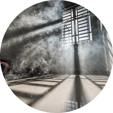
When Austin wildfire smoke readings are elevated, closing windows and doors is the right first move. But most residential HVAC systems keep running on standard MERV 8 filters that were never built to capture particles as fine as wildfire smoke. PM2.5 particles measure 2.5 micrometers or smaller — invisible to the naked eye, and small enough to travel deep into lung tissue — and a MERV 8 filter lets the majority of them pass through and recirculate inside the home.
After serving more than two million households, the pattern we've seen consistently is this: families shelter indoors during smoke events while indoor air quality keeps dropping, because their filter isn't rated for the particle size wildfire smoke produces. Setting your HVAC to recirculate mode closes off the outdoor air intake. A MERV 13 filter, the minimum rating the CDC and EPA recommend during wildfire smoke events, gives your system the filtration efficiency to capture PM2.5 and bring indoor smoke concentration down in a meaningful way. That single upgrade is one of the highest-value steps an Austin homeowner can take before smoke arrives.
"Wildfire smoke particles sit at 0.4 to 0.7 micrometers in diameter. A MERV 8 filter, which is what most Austin homes are running, captures particles down to about 3 micrometers. That gap is where smoke gets through. When we see AQI readings spike during a Texas wildfire event, the indoor air quality inside a home with an inadequate filter often mirrors the outdoor reading within 30 to 60 minutes. Switching to MERV 13 and closing the outdoor air damper changes that equation significantly."
7 Essential Resources
Check Your Live Austin AQI and Wildfire Smoke Map — EPA AirNow
The EPA AirNow platform is the primary federal tool for real-time air quality monitoring during wildfire events. For Austin households, the most useful page during an active smoke event is the Fire and Smoke Map at fire.airnow.gov, a joint product developed by the EPA and U.S. Forest Service. It combines air quality readings from thousands of regulatory monitors and crowdsourced PurpleAir sensors, layered alongside confirmed fire locations from the National Interagency Fire Center and NOAA smoke plume data. To see smoke plumes, toggle "NOAA Smoke Plumes" in the map's settings.
The standard AirNow Austin page shows the current NowCast AQI for ozone and PM2.5 separately, a color-coded health category, recommended protective actions, and a next-day forecast. The NowCast algorithm updates air quality in near real time, using multiple hours of recent monitor data and weighting toward more current readings when conditions are changing rapidly — exactly the behavior that matters most when a smoke plume is moving toward Travis County. Residents can also sign up for free EnviroFlash email alerts through AirNow, which send a notification whenever the Austin AQI crosses a threshold they set.
Source: https://www.airnow.gov/?reportingArea=Austin&stateCode=TX
Track Every Active Wildfire in Texas by Name and Perimeter — InciWeb
InciWeb is the official interagency incident information system operated by the National Wildfire Coordinating Group. It serves as the single authoritative source for public information on confirmed active wildfires across the United States, and it's the same system that public information officers and incident commanders use to communicate status updates during active fire events. The platform migrated to a new URL (inciweb.wildfire.gov) in October 2022; any older bookmark using inciweb.nwcg.gov will redirect there.
For each active incident, InciWeb provides the fire's name, the agency managing it, the most recent containment percentage, total acres affected, and any associated evacuation orders or closures. Where perimeter data is available, the map displays the fire's confirmed boundary rather than just a point location. The Texas state filter at the link below shows every incident currently under management by federal and state wildland fire agencies in Texas, sorted by most recently updated. During periods of elevated fire activity in the Hill Country, Panhandle, or Trans-Pecos region, this is the fastest way to confirm whether a specific fire is the source of smoke reaching Austin.
Source: https://inciweb.wildfire.gov/state/texas
Monitor Austin-Area Air Quality Across 200+ Texas Stations — TCEQ Air Monitoring
The Texas Commission on Environmental Quality operates the most extensive state air quality monitoring network in the country, with more than 200 stationary monitoring stations serving over 25 million Texans. The network includes more than double the number of stations required by federal Clean Air Act rules. Austin-area monitors measure PM2.5, ozone, sulfur dioxide, and a range of volatile organic compounds. All stations undergo daily automated checks and weekly in-person visits from TCEQ personnel to verify calibration and data quality.
Two TCEQ tools are most useful during wildfire events. The GeoTAM Dashboard provides a live geospatial view of current ambient air values at each monitoring site, displayed on an interactive map. For Austin residents who want to see which specific stations are tracking air near their neighborhood, the TCEQ Air Monitoring Sites regional map shows individual monitor locations, what each one measures, and links to current and historical readings. Data from TCEQ stations feeds directly into the EPA AirNow platform, so the readings you see on AirNow for Austin are sourced from this network.
Source: https://www.tceq.texas.gov/airquality/monops
Find Active Fires and Evacuation Points in Travis County — Travis County Wildfire Hub
The Travis County Office of Emergency Management operates a dedicated wildfire information hub that consolidates live fire maps, temporary evacuation points, and overnight shelter locations for the Austin-Travis County region in one place. The hub links directly to the WarnCentralTexas.org emergency notification system, which covers a 10-county region including Travis, Williamson, Bastrop, Hays, and Blanco counties. WarnCentralTexas.org uses the 9-1-1 address database to route alerts, but only reaches cell phones when residents register their mobile number separately through the system.
The Travis County Wildfire Hub also carries the community's most current Community Wildfire Protection Plan (CWPP) data. The CWPP identifies areas of elevated wildfire risk within Travis County, and a 2026 update cycle is currently underway with input from the Austin-Travis County Wildfire Coalition. For Austin residents who want a single bookmark for monitoring both active fires and local protective action status during a wildfire event, this hub gives the most locally specific picture of what emergency management is tracking and recommending in real time.
Source: https://oem.traviscountytx.gov/pages/travis-county-wildfire
Track Texas Wildfire Preparedness Levels and Fire Weather — Texas A&M Forest Service
Texas A&M Forest Service is the lead state agency for wildfire response in Texas, and its current wildfire status page is the most complete single source for understanding both what is actively burning and what conditions could drive new fire activity toward Austin. The page shows the current statewide Wildfire Preparedness Level on a scale of 1 to 5, which reflects the agency's assessment of fuel conditions, weather, and suppression resource availability across Texas. A Preparedness Level of 3 or higher typically signals elevated fire weather conditions in one or more regions.
The agency's live Texas wildfire incident viewer at tfswildfires.com/public shows every active wildfire that Texas A&M Forest Service personnel are responding to, updated as containment reports come in. For longer-range monitoring, the Fire Danger page provides weekly fire potential updates built from fuel moisture samples, weather station data, and coordination with the National Weather Service. The agency operates more than 150 remote automated weather stations (RAWS) across Texas, and those readings feed into both the fire potential assessments and the Southern Plains Wildfire Outbreak watches that are most relevant to smoke reaching the Austin metro.
Source: https://tfsweb.tamu.edu/wildfire-and-other-disasters/current-wildfire-status/
Get the CDC's Step-by-Step Wildfire Smoke Safety Guidance
The CDC's wildfire safety page covers protective actions before, during, and after a smoke event, organized around both the health risk categories and the specific household steps that reduce PM2.5 exposure. The guidance explicitly recommends MERV 13 or higher as the minimum filter efficiency for HVAC systems running during wildfire smoke events, and it addresses HVAC recirculation mode, N95 respirator use for necessary outdoor exposure, and how to set up a designated cleaner air room inside the home for households that can't fully seal against infiltrating smoke.
The page was last updated in April 2024 and includes specific guidance for higher-risk populations: children under two (who cannot safely wear respirators or masks), people with asthma, COPD, heart disease, diabetes, and chronic kidney disease, and people who are pregnant. For Austin families with members in any of those categories, the CDC guidance page provides the most current federal health recommendations for tailoring smoke response to specific household needs.
Source: https://www.cdc.gov/wildfires/safety/how-to-safely-stay-safe-during-a-wildfire.html
Sign Up for Austin Emergency Alerts and Know Your Evacuation Assembly Points
The City of Austin and Travis County co-manage the Active Emergency Information Hub at austintexas.gov/alerts, which serves as the official source for real-time emergency updates during any active wildfire event affecting the Austin area. During a wildfire evacuation, the page posts Temporary Assembly Point (TAP) locations where residents check in with City officials upon leaving their homes. The TAPs are staffed by Austin/Travis County EMS and coordinated with Austin Police and Austin Fire for safety assessment and shelter referrals.
Austin residents can sign up for ReadyCentralTexas.org alerts through the portal, which provides preparedness guidance and emergency notification registration. The STEAR program (State of Texas Emergency Assistance Registry) is also accessible through this portal and is specifically designed for households where a member has medical conditions, mobility needs, or communication requirements that would require additional assistance during an evacuation. The portal offers real-time updates in 13 languages including Spanish, Vietnamese, Arabic, French, Somali, Nepali, Hindi, Korean, and Burmese. During periods with no active emergency, residents can use the portal to build family emergency plans and download preparedness checklists.
Source: https://www.austintexas.gov/alerts
Supporting Statistics
Texas Wildfires: A Scale Most Residents Underestimate
Between January 2005 and December 2022, wildfires burned more than 12.4 million acres across Texas — an area larger than the state of Maryland. And 85 percent of those fires ignited within two miles of a community. Working with homeowners across the country, we find that wildfire risk is consistently underestimated in urban and suburban markets, including Central Texas. The Austin metro is close to fire-prone Hill Country terrain, and proximity to ignition sources matters as much as the fire itself.
Source: https://tfsweb.tamu.edu/content/landing.aspx?id=19705
AQI 101: The Number That Changes What Austin Families Should Do
An AQI reading at or below 100 is generally considered satisfactory. When the Austin TX AQI live reading crosses 101, the EPA classifies air quality as Unhealthy for Sensitive Groups — the threshold at which children, older adults, and people with asthma, heart disease, or lung disease face elevated health risk from PM2.5 exposure. Once the reading hits 151, the entire population is at risk, not just sensitive groups. Knowing where that line sits, and checking AirNow before any outdoor activity decisions during wildfire season, is one of the most practical habits an Austin family can build.
Source: https://www.epa.gov/wildfire-smoke-course/communicating-air-quality-conditions-air-quality-index
The Most Destructive Texas Fires Come from a Small Fraction of Events
Since 2005, Southern Plains Wildfire Outbreak events have accounted for just 3 percent of reported wildfires in Texas, but they're responsible for 49 percent of total acres burned. These events run on the same conditions that make smoke travel: dry cured grasses, extreme wind, and low relative humidity. An outbreak burning in the Panhandle or along the Southern Plains can push smoke columns hundreds of miles southeast toward Austin within hours. Monitoring the Texas wildfire tracker during outbreak-risk periods is essential, not optional.
Source: https://tfsweb.tamu.edu/wildfire-and-other-disasters/southern-plains-wildfire-outbreak/
Final Thoughts and Opinion
Wildfire smoke in the Austin area is not a seasonal curiosity. Texas wildfires now burn longer, move faster, and push smoke into communities that considered themselves removed from fire risk. The Austin metro sits at the edge of the Hill Country and within reach of Southern Plains fire weather systems that can escalate from low threat to extreme conditions in under 24 hours.
Two habits do most of the protective work: checking the live Austin, TX wildfire map and AQI reading daily during fire season, which takes under a minute, and keeping a MERV 13 filter installed before smoke arrives. Neither one requires a news alert or a red sky to trigger it.
The smoke is invisible long before it looks dangerous. Getting ahead of it, rather than reacting to it, is the most effective way to protect the people inside your home.
Next Steps
Check the live Austin AQI reading before opening windows, exercising outdoors, or sending children outside.
Set your HVAC system to indoor recirculation mode to block outdoor smoke intake when AQI exceeds 100.
Upgrade to a MERV 13 air filter if your current filter is rated below MERV 11.
Register your mobile number at WarnCentralTexas.org to receive Travis County emergency alerts directly.
Bookmark the Texas A&M Forest Service current wildfire status page and the Travis County Wildfire Hub ahead of fire season.
Frequently Asked Questions
The One Upgrade Austin Homes Need Before Smoke Season
Wildfire smoke doesn't wait for a convenient moment. When active wildfires near Austin push PM2.5 into the air, your HVAC system keeps running regardless — the only variable is what it's filtering through. A standard MERV 8 filter wasn't rated for particles that small. MERV 13 was.
Filterbuy MERV 13 filters are manufactured in the United States, ship directly to your door, and come in hundreds of sizes to fit your system. Put one in before the next smoke event. Your household will be protected.
Shop MERV 13 Air Filters for Wildfire Smoke Protection at Filterbuy.com