The moment a wildfire starts near you, you'll get an instant alert and simple tips to reduce your smoke exposure.
30xSmaller than a human hair
Fine enough to reach deep into the lungs. A MERV 13 is built to capture it.
It Doesn't Stay Local
Smoke rides the wind far downwind — you can get smoky air with no fire nearby.
Simple steps to reduce indoor exposure.
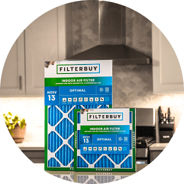
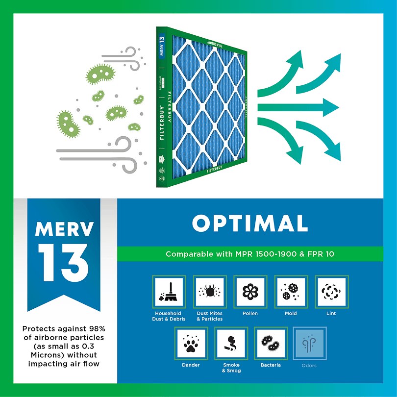
During smoke events, the EPA recommends upgrading to a MERV 13 filter — or the highest-rated filter your system can handle — to help reduce the fine particles smoke brings indoors. MERV 13 is the level most home HVAC systems can run while still capturing PM2.5, the fine particulate that makes up the bulk of wildfire smoke.
Over 70,000 wildfires burn in the U.S. every year.
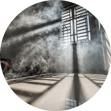
Wildfire smoke can travel 1,000+ miles, affecting states that aren't even near the blaze.
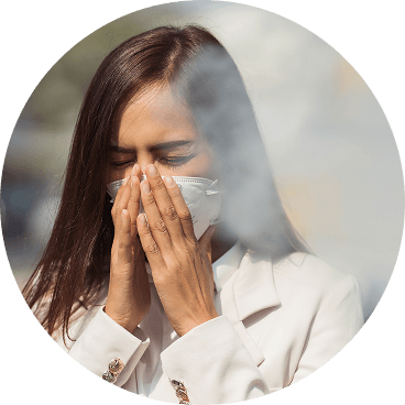
Exposure to wildfire smoke can worsen asthma, trigger heart issues, and lead to ER visits.
Indoor air can hold more fine particles during wildfire events unless it's properly filtered.
The EPA advises using MERV 13 filters or portable HEPA air cleaners during wildfire smoke events.
Use the live wildfire smoke tracker and upgrade your air filters today to protect your lungs and your home.
Shop Filters For Smoke Protection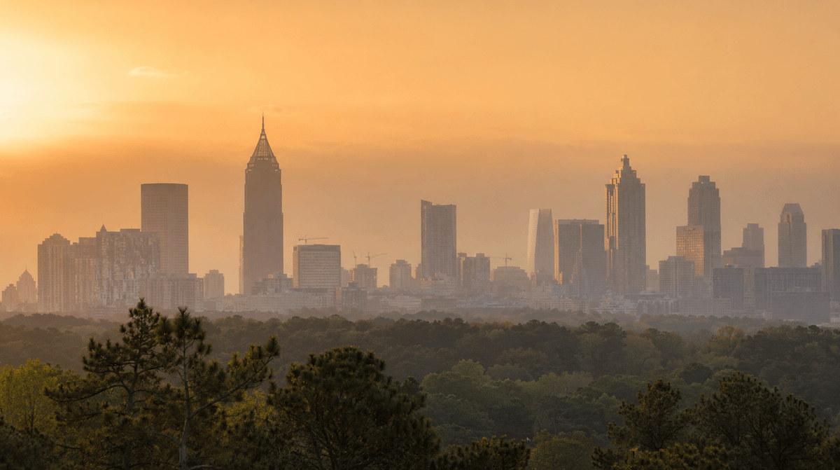
By Michelle Wan, Filterbuy Content Team
Reviewed by David Clark, Licensed HVAC Technician
Published: July 6, 2026 | Updated: July 6, 2026
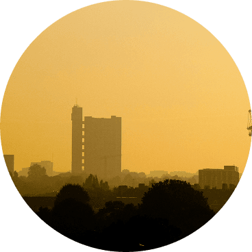
In April 2026, smoke from wildfires burning more than 200 miles south of Atlanta drifted north over the metro area, greying the skyline and pushing fine-particle readings up across neighborhoods from Buckhead to East Point. Atlanta itself rarely burns, but the city sits downwind of Georgia’s vast pine forests and the wider Southeast, so smoke arrives here without a single flame inside the perimeter.
This page tracks that risk in real time. The live map below reads current fire and air-quality data for Atlanta, and the guidance underneath it shows you how to read what the map is telling you, when to act, and how to keep your home’s air breathable while the smoke passes. Filterbuy built this resource so a family can check one place, understand the number they see, and protect the people inside the house that same afternoon. We build these filters ourselves, and years of Southeast fire seasons have taught us that the households that stay comfortable through a smoke event are the ones that prepared before the haze arrived.
Atlanta has no large wildfires inside the city, but smoke from fires elsewhere in Georgia and neighboring states can reach the metro area and raise particle pollution for days at a time. The live map on this page reads current AirNow data to show active fires, smoke plumes, and the local air quality index for Atlanta right now. When smoke arrives, a sealed home paired with a MERV 13 HVAC filter gives the strongest everyday protection for most households.
The AirNow Fire and Smoke Map is the authoritative real-time source for Atlanta wildfire smoke and PM2.5 levels, and it powers the live Filterbuy map on this page.
Wildfire smoke is mostly PM2.5, fine particles smaller than 2.5 micrometers that travel deep into the lungs and can enter the bloodstream.
The EPA recommends a MERV 13 HVAC filter to capture and reduce the very small particles in wildfire smoke, though a MERV 13 filter is not a HEPA filter.
Georgia’s spring 2026 drought produced one of the state’s worst wildfire seasons on record, and that smoke reached Atlanta more than 200 miles to the north.
Sensitive groups feel smoke first: children, older adults, pregnant people, and anyone with asthma, COPD, or heart disease.
During heavy smoke, Atlanta residents should close windows, run the HVAC fan continuously, and spend time in one cleaner-air room.
The live map shows three things at once for the Atlanta area: active fire locations, the shape and density of smoke plumes overhead, and colored monitor dots that report the current air quality index at ground level. Read the monitor dot closest to your neighborhood first, because that number reflects the air you are actually breathing, not the smoke drifting far above it.
If the layers and colors are new to you, our step-by-step guide to reading a wildfire smoke map explains each marker, the AQI color scale, and the trend line in plain language.
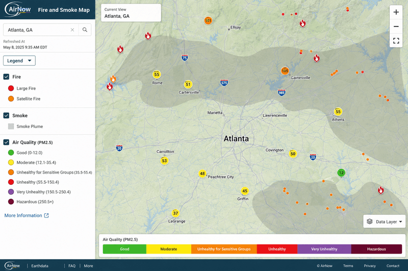
Fire markers: flame icons mark reported wildfires and larger prescribed burns. Tap one for its size and containment.
Smoke plumes: shaded gray bands show where satellites detect smoke aloft. Light, medium, and heavy shading signal how thick that smoke is.
Monitor dots: colored circles report the ground-level air quality index from permanent monitors and low-cost sensors near you.
Atlanta’s air quality changes hour to hour during a smoke event, so the color on the map matters more than any single reading. The air quality index runs from 0 to 500 and sorts into six categories, each tied to a clear action. Match the number on your nearest monitor to the row below, then follow the guidance for that band.
The AQI scale runs 0 to 500 and is set by the U.S. EPA. Row colors follow the standard AQI scale.
For a reading tied to your own address, you can also look up your AQI by ZIP code and compare it against the monitors on the map above.
As of early July 2026, active wildfire activity across Georgia had eased from the spring, helped by summer thunderstorms and higher humidity, though state officials kept the region at a raised national preparedness level because drought lingered in parts of the state. Conditions can shift within a day, which is why the live map above, not this paragraph, is the current answer for Atlanta.
Wind carries wildfire PM2.5 for hundreds of miles, so Atlanta can wake up to hazy air while the nearest fire burns in south Georgia, Florida, or the Carolinas. In spring 2026, extreme drought worsened by fuel left behind from Hurricane Helene drove one of Georgia’s most destructive fire seasons in memory. The Pineland Road Fire alone grew past 32,000 acres, and shifting winds pushed that smoke into the northern part of the state, including metro Atlanta.
Where Atlanta’s Smoke Comes From Season By Season
Atlanta’s smoke rarely starts nearby. It rides in on the wind from a few predictable directions, and the season tells you where to look first.
Spring: this is Atlanta’s highest-smoke stretch. Fires and prescribed burns across South Georgia and Florida ride north on warm southerly winds, the same pattern that greyed the skyline in 2026. The smoke often arrives on top of the city’s heavy tree pollen, so a MERV 13 filter works against two particle loads at once.
Fall: dry autumn spells can push smoke down from brush and forest fires in North Georgia and the southern Appalachians, usually in shorter bursts than the spring events.
Summer: local fires are rare, and most summer haze is distant Western or Canadian smoke drifting in high overhead rather than a fire near the metro.
Atlanta also faces a second, separate air-quality problem in summer. Hot, stagnant days push ground-level ozone up, and the Georgia Environmental Protection Division issues Code Orange ozone alerts for the metro area during those spells. Smoke and ozone are different pollutants, but a MERV 13 filter and a sealed home help most on the smoke, particle side.
Wildfire smoke irritates the eyes, nose, throat, and lungs, and it can trigger coughing, wheezing, chest tightness, and asthma attacks. The fine particles in smoke reach the deepest parts of the lungs and can pass into the bloodstream, which is why the CDC and the American Lung Association treat smoke as a risk for everyone, not just the people who already feel sick.
Some groups feel the effects first and hardest: children, older adults, pregnant people, and anyone with asthma, COPD, heart disease, or diabetes. Filters and sealed homes reduce how much smoke reaches these lungs, but no filter kills a virus or cures a condition. Air filtration captures particles and lowers exposure, and that reduction is what protects your household.
When the map turns orange or worse, work through these steps in order. These are the same steps Filterbuy shares with Atlanta households, and each one lowers the amount of smoke that reaches the people inside your home.
Check the live map and your nearest AQI reading first, so you act on the current number rather than on how the sky looks.
Seal the house. Close windows and doors, set the HVAC fan to "on" instead of "auto" so it filters constantly, and close any fresh-air intake so the system recirculates indoor air.
Upgrade to a MERV 13 filter. The EPA recommends MERV 13, or the highest rating your system accepts, to capture the fine particles in smoke. Keep spare filters on hand and change them more often during a smoke event, because heavy smoke loads a filter fast.
Set up a cleaner-air room. Pick a room with few windows, run a portable air cleaner sized for the space, and have the household spend time there when smoke is heavy.
Wear an N95 if you must go outside, and keep trips short when the index sits in the red or purple bands.
Avoid adding indoor particles. Skip candles, frying, gas stoves, and vacuuming without a HEPA vacuum while the air outside stays smoky.
One point trips people up: a MERV 13 filter is not a HEPA filter. HEPA sits far higher on the scale, around MERV 17 to 20. MERV 13 is the practical grade for a home HVAC system because it captures a large share of smoke particles while still letting your blower move enough air.
If we had to name the step people skip most, it would be the fan setting. Left on "auto," the system only filters while it is heating or cooling, so smoke keeps circulating in the hours between. During a smoke event we tell every Atlanta customer the same thing, which is to switch the fan to "on" and leave it there. It costs nothing and does more for your indoor air than almost anything else in the house.
After manufacturing filters for over a decade and serving more than two million households, we have seen how fast smoke changes the air inside a home. The calls climb the day the sky turns, and it is almost always a family reaching for a filter once the smoke is already indoors. When the map turns orange, though, the fix is not complicated. Seal the house, put a MERV 13 filter in the system, and keep the fan running. That combination captures the fine particles that make Atlanta families cough, and it keeps working long after the haze clears.
David Heacock, Founder and CEO, Filterbuy
Every link below points to an authoritative government or nonprofit source. Bookmark them before fire season so you are not searching for them mid-event.
1. AirNow Fire and Smoke Map (EPA and U.S. Forest Service)
Source: AirNow Fire and Smoke Map shows real-time fires, smoke plumes, and PM2.5 monitor readings for Atlanta and the rest of the country.
2. EPA: Wildfires and Indoor Air Quality
Source: EPA guidance on wildfires and indoor air quality explains sealing your home and choosing a MERV 13 HVAC filter for smoke.
3. CDC: Staying Safe During a Wildfire
Source: CDC wildfire safety guidance covers health symptoms, cleaner-air rooms, and who is most at risk from smoke.
4. National Weather Service Atlanta and Peachtree City
Source: National Weather Service Atlanta and Peachtree City forecast office issues local air quality alerts and fire weather forecasts for the metro area.
5. FEMA Ready: Wildfires
Source: FEMA Ready wildfire preparation and evacuation guide walks through go-bags, evacuation routes, and alerts for households near fire risk.
6. Georgia Forestry Commission Public Viewer
Source: Georgia Forestry Commission fire and smoke Public Viewer maps active Georgia wildfires, prescribed burns, PM2.5 readings, and smoke forecasts statewide.
7. Georgia Ambient Air Monitoring (Georgia EPD)
Source: Georgia Environmental Protection Division air quality forecast for Atlanta posts the daily Atlanta air quality forecast from the state Air Protection Branch.
Three findings back the guidance on this page.
Wildfire smoke hits the lungs harder than ordinary air pollution. Wildfire PM2.5 raised respiratory hospitalizations 1.3% to 10% for every 10 micrograms per cubic meter. Other particle pollution raised them 0.67% to 1.3%.
Source: Aguilera et al., 2021, Nature Communications (PMC7935892)
Georgia declared a 91-county state of emergency in 2026. In April 2026, the Governor declared a State of Emergency for 91 counties as wildfires spread across South Georgia. That smoke reached metro Atlanta.
Source: Georgia Emergency Management Agency April 2026 wildfire declaration
More than 150 million Americans breathe failing-grade air. About 152.3 million people, roughly 44% of Americans, live in counties failing for ozone or particle pollution. The report ties that burden to wildfire smoke and extreme heat.
Source: American Lung Association State of the Air 2026 key findings
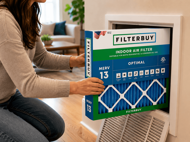
The habit that protects an Atlanta household is not checking the map during an emergency. It is checking it as a routine through fire season, the same way you glance at the pollen count in spring. By the time the sky looks hazy, smoke has already been in the air for hours, and a family that waits for the visible cue loses the easiest window to seal the house and swap in a fresh MERV 13 filter.
Filterbuy’s view, after years of making filters for homes across the Southeast, is that filtration works best as a standing defense rather than a scramble. Keep a spare high-efficiency filter in the closet, know which room becomes your cleaner-air room, and treat the live map as a five-second daily check. Small, boring preparation beats a frantic hardware-store run every time the wind turns.
Turn this into action for your own home in the next few minutes.
Check your nearest reading on the live map above and note the color band.
Confirm your current filter size, then order MERV 13 replacements so you have spares ready before the next smoke event.
If your return grille does not take a standard size, build a custom-size filter cut to your exact dimensions.
For conditions beyond the metro area, check the Filterbuy national live wildfire and smoke map to see where smoke is moving across the country.
Atlanta rarely has large wildfires inside the city itself. The real question is whether smoke from fires elsewhere has reached the metro area. Check the live map above for the current answer, because conditions change within a day.
Use the Filterbuy live map on this page, which reads the AirNow Fire and Smoke Map data for Atlanta. Look at the colored monitor dot nearest your neighborhood for the current air quality index.
An index above 100 is unhealthy for sensitive groups, and above 150 is unhealthy for everyone. At 151 or higher, all Atlanta residents should reduce outdoor activity and seal the home.
The EPA recommends a MERV 13 filter, or the highest rating your HVAC system accepts. MERV 13 captures a large share of the fine particles in smoke while still letting your system move enough air. Filterbuy makes MERV 13 in over 600 sizes, so most Atlanta homes can match their existing filter dimensions.
Yes. Close the windows and doors and run the HVAC fan continuously. That keeps much of the outdoor smoke outside and lets your filter clean the air indoors. It is one of the most effective free steps you can take.
Yes. Wind carries PM2.5 for hundreds of miles, so smoke from Florida, the Carolinas, or south Georgia can settle over Atlanta even when no fire burns nearby.
Wait until your nearest monitor is back in the green or low yellow and holding there, not just dipping for a few minutes. Watch the trend on the live map rather than a single reading. Once the air stays clear, open the windows and run your kitchen and bathroom exhaust fans to flush out any smoke that settled inside, then check your filter.
Change it more often than usual. Smoke loads a filter far faster than everyday dust, so a filter that would normally last three months can gray out within a few weeks of heavy smoke. Check it every couple of weeks while the air stays smoky, and replace it when it looks dark or your airflow drops. A spare in the closet means you are not hunting for one mid-event.
You cannot stop the wind from carrying smoke into Atlanta, but you can control the air inside your home. A sealed house and a fresh MERV 13 filter turn your HVAC system into a defense that runs day and night while the haze passes.
Ready now? Shop Filterbuy MERV 13 filters, made in the USA in over 600 sizes and shipped free to your door, so a clean one is in place before the next smoke event.
Air Quality Index (AQI): A 0-to-500 scale from the EPA that reports how clean or polluted outdoor air is and what health effects to expect. Higher numbers mean worse air.
PM2.5: Fine particulate matter smaller than 2.5 micrometers across. It is the main pollutant in wildfire smoke and small enough to reach deep into the lungs.
MERV: Minimum Efficiency Reporting Value, a 1-to-16 scale that rates how well an HVAC filter captures airborne particles. Higher MERV captures smaller particles.
MERV 13: A high-efficiency HVAC filter grade the EPA recommends for wildfire smoke. It captures a large share of PM2.5 but is not the same as a HEPA filter.
HEPA: High-Efficiency Particulate Air filtration, roughly equal to MERV 17 to 20. HEPA filters are used in portable air cleaners, not typical home HVAC systems.
N95: A respirator that seals to the face and filters at least 95% of airborne particles, including the fine particles in wildfire smoke.
Cleaner-Air Room: A room set up to keep smoke levels low, usually with few windows and a portable air cleaner, where a household spends time during heavy smoke.
AirNow Fire and Smoke Map: The EPA and U.S. Forest Service tool that shows real-time fires, smoke plumes, and PM2.5 readings. It powers the live map on this page.
Wildland-Urban Interface (WUI): The zone where homes and development meet forests or wild vegetation, where wildfire risk to property is highest.
Subscribe to wildfire smoke alerts for Atlanta, GA, to get a heads-up before the next event reaches your area.