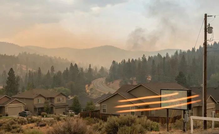
If you're searching for a current live forest wildfire and smoke map today in San Jose, CA, you need answers right now — not tomorrow. Whether you just spotted haze creeping over the Santa Cruz Mountains or caught that unmistakable smell of smoke drifting through your neighborhood, knowing where active wildfires are burning and how smoke is moving toward your home is critical.
At Filterbuy, we're obsessed with the air your family breathes — and after manufacturing millions of air filters and helping households across the country navigate wildfire seasons, we've seen firsthand how quickly smoke events can turn from a distant headline into a serious indoor air quality emergency. Our customers tell us the same thing every fire season: they didn't realize how fast fine particulate matter from wildfires infiltrates their homes, even with windows closed.
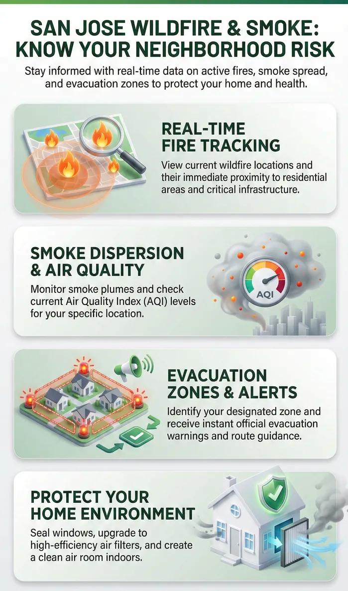
This page gives you direct access to real-time wildfire tracking maps, live smoke and air quality overlays, and current evacuation zone information specific to San Jose and Santa Clara County — sourced from Cal Fire, AirNow, and local emergency management agencies. Below, you'll also find expert guidance on protecting your indoor air when smoke conditions worsen, because tracking the fire is only half the battle.
What most San Jose residents don't realize is that wildfire smoke particles are 30 times smaller than a human hair, meaning your HVAC system becomes your home's first line of defense. Bookmark this page — when wildfire season threatens the South Bay, one reliable source for information regarding live conditions and indoor air protection can make all the difference.
Is Your Neighborhood at Risk? Current Live Forest Wildfire and Smoke Map Today in San Jose, CA | Evacuation Zones
Yes — every San Jose neighborhood faces some level of wildfire smoke risk during fire season. The city sits between the Diablo Range and Santa Cruz Mountains, meaning fires burning in virtually any direction across Northern California can push hazardous smoke into the South Bay within hours.
Check your risk right now:
Active fires: Cal Fire incident map at fire.ca.gov/incidents
Smoke and air quality: AirNow Fire and Smoke Map at fire.airnow.gov
Evacuation zones: Santa Clara County OEM at oem.santaclaracounty.gov
Emergency alerts: Register free at alertscc.com
What most San Jose residents don't realize: Even when fires burn 50 to 100 miles away, the EPA confirms that 55% to 60% of outdoor smoke particles infiltrate homes with windows and doors closed. After manufacturing millions of air filters and working with Bay Area households through multiple fire seasons, we've seen this catch families off guard year after year.
Protect your indoor air in two steps:
Install a MERV 13 air filter in your HVAC system
Switch your thermostat fan from "auto" to "on" for continuous filtration
The EPA reports this combination can reduce indoor wildfire smoke particles by approximately 50%. Track the fire on the map. Protect your air with the right filter. Both matter.
Track fires and smoke in real time. Bookmark this page for live wildfire maps, AirNow smoke overlays, and evacuation updates for San Jose.
Conditions shift within hours. Check at least twice daily during active fire season.
Closing your windows isn't enough. The EPA confirms 55% to 60% of outdoor smoke particles still infiltrate your home with everything shut.
Your HVAC filter is your actual first line of defense — not your window locks.
A MERV 13 filter is the single highest-impact upgrade you can make. EPA data shows that a high-efficiency filter running continuously cuts indoor smoke particles by approximately 50%. A standard filter only reduces them by about 24%. One swap. Five minutes. Measurable protection.
Prepare before smoke arrives — not after. MERV 13 filters sell out fast once smoke hits the Bay Area.
Register for AlertSCC now. Plan your evacuation routes now. Install your filter now. Every fire season, our customers tell us the same thing: they wish they hadn't waited.
Wildfire preparedness without indoor air quality preparation is incomplete. Maps, alerts, and evacuation plans protect you from the fire. A MERV 13 filter, continuous fan operation, and a clean air room protect you from the far more common threat — days or weeks of smoke exposure while you remain in your home.
The interactive map above retrieves real time data on Cal Fire, FIRMS satellite detection system of NASA and the National Interagency Fire Center to tell you exactly where the active wildfires are in the San Jose area and other surrounding areas. Fire perimeter updates every time the conditions are different and provides you with the latest picture of the fires in relation to your neighborhood. Switch between fire perimeter data, smoke plume data and air quality index data to see the big picture of the current wildfire action in the South Bay.
San Jose is located in a unique geographic location encircled by the Diablo Range on the east and the Santa Cruz Mountains on the west and open grassland corridors capable of directing the wild fires toward residential areas with limited warning. Neighborhoods along the wildland-urban interface such as those along Alum Rock Park, the foothills to the east of the Evergreen and neighborhoods along the Sierra Azul Open Space Preserve have historically been at the highest risk of wildfire in dry, windy weather. When fires start in such areas the wind patterns that prevail can blow smoke right to downtown San Jose and the suburbs within few hours.
The smoke of wildfires does not respect property boundaries. Fine particulate matter may cover San Jose even when fires are underway over a distance of 50 or more miles based on the wind direction, atmospheric pressure and temperature inversions that are typical of the Bay Area. The AirNow Fire and smoke map on this page will display you with real time PM2.5 readings at monitoring stations around the entire county of Santa Clara so that you can determine the real-time conditions at the ground level rather than what your eyes and nose are telling you.
Filterbuy has spent years assisting customers in overcoming the wildfire smoke events, and one thing that we have learned is that outdoor air quality readings are not the whole narrative. Our clients have continuously documented that the indoor PM2.5 levels skyrocket when there is a smoke event and the HVAC system is older or the filter is not rated. Your house is not the hermetically closed world you may think it can be. If you live in a different region, you might be looking for local HVAC experts to help secure your home's air systems.
In the cases of active wildfire incidents in the area of San Jose, evacuation orders and warnings are dispatched on a zone-by-zone basis by the Santa Clara County Office of Emergency Services. This page leads to the official evacuation map of the county which is updated in real time as the situation is changing. To receive emergency alerts on your phone, we suggest that you bookmark the following resources and turn on emergency alerts:
The evacuation orders are zone-based through Santa Clara County Emergency Portal.
The county has an official emergency notification system, which is the AlertSCC.
The incident page of Cal Fire monitors all the active fires in the state.
Ready Santa Clara County has pre-evacuation planning checklists and shelter sites.
Being familiar with your evacuation area will remove potentially fatal indecison during a fast escalation of the situation.
This is where the majority of wildfire preparedness guides come to an end yet this is precisely where your family is at risk of their health. The smoke of a wildfire can be PM2.5 particles so tiny that they do not go through the natural defenses of the body and instead enter deep into the lung tissue. In the event that the quality of air outdoors is of unhealthy standard, the HVAC system becomes the first line of defense between those particles and the lungs of your family.
Having produced millions of filters, and having been on the ground directly working with homes during the largest wildfire incidents in the West Coast, we have figured out what measures actually make a difference inside the home. Leaving your HVAC fan on the on option as opposed to the auto option causes the air to pass through your filter at all times, and results in filtration taking place even when you are not heating or cooling.
An upgrade to a MERV 13 filter traps the small particles that the wildfire smoke is composed of - the normal fiberglass filters with a rating of MERV 1-4 allows most of the smoke particles to pass directly through. You should research the recommended MERV rating to ensure your equipment can handle the increased resistance. Caulking the doors, windows and entrance points to attic prevent the unfiltered smoke to go past your HVAC system all together. Every time in a fire season customers say that they wish they had replaced their filter before the smoke got to their homes instead of rushing about when air quality alerts had already been declared. The best thing to do is to always have the right filter before things can go wrong.
During active fire events near San Jose, conditions can shift dramatically within hours. We recommend checking the live map at least twice daily — morning and evening — since wind patterns in the Bay Area typically shift overnight and again in late afternoon. If you notice visible haze, a sudden drop in air quality readings, or receive any emergency notification, check immediately and verify your evacuation zone status.
Between active events, staying aware of Red Flag Warnings issued by the National Weather Service for the Bay Area helps you prepare before fires start. These warnings indicate the combination of low humidity, dry vegetation, and high winds that create the most dangerous wildfire conditions in the hills surrounding San Jose.
"After helping thousands of households protect their indoor air during wildfire smoke events, we've seen the same pattern repeat every fire season — families assume closed windows are enough, but our air quality data consistently shows that homes without properly rated MERV 13 filters experience indoor PM2.5 spikes nearly as severe as outdoor conditions, turning what should be a safe refuge into an extension of the smoke cloud outside."
Tracking active wildfires and protecting your family from smoke exposure requires more than a single map — it takes a network of trusted, authoritative resources working together. After helping thousands of households navigate wildfire seasons, we've identified the seven most critical tools and guides that every San Jose and Santa Clara County resident should bookmark before fire season intensifies.
To display wildfire PM 2.5 particle pollution in a single interactive map, the EPA and U.S. Forest Service constructed this interactive map to display permanent monitoring data, low-cost sensors, and satellite-detected fire locations. Type in your San Jose ZIP code and check the current Air Quality Index, smoke plume movement, of your neighborhood and also whether our conditions are getting better or worse every hour. Source: U.S. Environmental Protection Agency & U.S. Forest Service URL: https://fire.airnow.gov/
Cal Fire has the most authoritative and regularly updated list of all ongoing wildfires over 10 acres undergoing in California with real-time fire boundaries, containment percentages, and official evacuation orders and warnings. It is the initial source to consult whenever you notice smoke in the distant or you get an alert of fire in San Jose area. Source: California Department of Forestry and Fire Protection (Cal Fire) URL: https://www.fire.ca.gov/incidents
The official emergency notification system in the Santa Clara County also provides zone-based evacuation instructions, shelter-in-place instructions, and road closure information to your cell phone, email, or landline within minutes after an emergency has been declared. Registration is not only free but also less than two minutes - and guarantees you will get necessary alerts even when you are not watching local news during a rapidly spreading wild fire. Source: Santa Clara County Office of Emergency Management URL: https://www.alertscc.com
The county has an emergency management portal that offers evacuation zone maps, predetermined sheltering sites as well as stepwise household planning resources, specifically in relation to hazards in Santa Clara County, such as wildfire, earthquake, and flooding hazards. Having several evacuation routes mapped out and assigned family meeting points in case of an emergency gets rid of the life-threatening indecisiveness that costs lives when the situation gets out of hand. Source: Santa Clara County Office of Emergency Management URL: https://oem.santaclaracounty.gov/prepare-4-steps/make-plan
Federal Evacuation Checklists and Emergency Supply Guides FEMA's wildfire preparedness hub provides comprehensive evacuation checklists, emergency supply kit lists, and family communication plan templates designed to work alongside your local county resources. Download the free FEMA app to receive real-time National Weather Service alerts for up to five locations — giving you early warning when Red Flag conditions develop near San Jose. Source: Federal Emergency Management Agency (FEMA) URL: https://www.ready.gov/wildfires
Most wildfire preparedness guides stop at evacuation planning, but the EPA's indoor air quality resource addresses what happens when you shelter in place, and smoke infiltrates your home despite closed doors and windows. This guide covers clean room setup, HVAC filter upgrades to MERV 13, portable air cleaner selection, and post-fire ash cleanup — the indoor protection steps that Filterbuy customers consistently tell us they wish they had known about before their first smoke event. Source: U.S. Environmental Protection Agency URL: https://www.epa.gov/emergencies-iaq/wildfires-and-indoor-air-quality-iaq
Your Family's Step-by-Step Fire Season Playbook Cal Fire's "Ready, Set, Go!" framework walks every household through creating a personalized Wildfire Action Plan covering defensible space, evacuation routes, emergency supply kits, pet and livestock arrangements, and communication strategies for when cell networks become congested. The downloadable action plan template ensures nothing gets overlooked during the stress of an actual emergency — print it, fill it out, and keep it with your go bag. Source: California Department of Forestry and Fire Protection (Cal Fire) URL: https://readyforwildfire.org/prepare-for-wildfire/wildfire-action-plan/
Pro Tip from Filterbuy: After manufacturing millions of air filters and working with customers through multiple wildfire seasons, we've found that the families who fare best during smoke events are the ones who paired their evacuation planning with indoor air quality preparation before fire season started. Bookmark these seven resources now, register for AlertSCC today, and make sure your HVAC filter is rated MERV 13 or higher — because once smoke fills the Bay Area sky, demand for high-efficiency filters spikes and availability drops fast.
After manufacturing millions of air filters and working directly with households during wildfire smoke events, we've developed a perspective that goes beyond what most resources tell you. These federal statistics validate what our customers experience every fire season.
The most common misconception we hear from customers during their first smoke event: closing windows and doors keeps smoke out. It doesn't. The U.S. EPA reports that indoor PM2.5 levels reach approximately 55% to 60% of outdoor levels during wildfire smoke events — even with doors and windows closed and no portable air cleaners running.
After years of fielding customer calls during fire season, we can tell you exactly why. Smoke particles measuring just 2.5 microns infiltrate through:
HVAC fresh air intakes pull unfiltered outside air into your system
Gaps around door frames, window seals, and weatherstripping
Electrical outlets, plumbing penetrations, and recessed lighting
Natural air exchange that every home experiences throughout the day
Closed windows are a starting point, not a solution. Your HVAC filter is the only thing actively removing particles once they're already inside. Source: U.S. Environmental Protection Agency — Strategies to Reduce Exposure Indoors https://www.epa.gov/wildfire-smoke-course/strategies-reduce-exposure-indoors
Most San Jose homeowners don't realize this until smoke is already in their living room: the standard fiberglass filter in your HVAC system — typically rated MERV 1 through 4 — was designed to protect your equipment from large debris, not your lungs from wildfire smoke.
The difference a proper filter makes is staggering:
MERV 13 or higher filter + fan running continuously: Approximately 50% reduction in indoor PM2.5 concentrations, according to the EPA
Standard low-efficiency filter + fan running continuously: Only about 24% reduction in particle concentrations
Standard filter on "auto" mode: Minimal protection — the fan only runs during heating or cooling cycles, leaving long gaps with zero filtration
That gap between 24% and 50% represents the particles your family is breathing unnecessarily. Many homeowners consider the HEPA vs MERV 16 comparison when looking for the highest level of protection available for their systems.
After over a decade of manufacturing filters across every MERV rating, we can tell you this single upgrade — which takes less than five minutes — is consistently the highest-impact change a homeowner can make during wildfire smoke events.
Two steps. Five minutes. Measurable protection:
Replace your current filter with a MERV 13
Switch your thermostat fan from "auto" to "on."
Customers who made this switch before smoke arrived tell us the difference was immediately noticeable compared to previous fire seasons. Source: U.S. Environmental Protection Agency — Strategies to Reduce Exposure Indoors https://www.epa.gov/wildfire-smoke-course/strategies-reduce-exposure-indoors
If you're questioning whether wildfire preparedness is necessary for a metro area like San Jose, the numbers are unambiguous:
2024: 8,024 wildfires burned a cumulative 1,050,012 acres across California — slightly exceeding the five-year average
2025 outlook: Cal Fire reports California faces elevated fire danger through the end of 2025, with conditions expected to improve in early 2026
Bay Area reality: San Jose sits between the Diablo Range and Santa Cruz Mountains, positioned to receive smoke from fires burning in virtually any direction across Northern California
What these statewide numbers don't capture is what we see in our own order data every fire season. The pattern repeats year after year:
A major fire ignites anywhere in Northern California
Smoke becomes visible in the Bay Area within 24 to 48 hours
Demand for MERV 13 filters from Bay Area zip codes spikes dramatically
Many filter sizes are backordered across the industry within days
The households that fare best are the ones that treated filter upgrades as fire season preparation — not emergency response. Preparation completed before smoke arrives is always more effective than scrambling once AQI alerts are already hitting your phone. Source: California Department of Forestry and Fire Protection (Cal Fire) — Statistics & Incidents https://www.fire.ca.gov/our-impact/statistics https://www.fire.ca.gov/incidents
Most wildfire preparedness resources stop at the map. They show you where fires are burning, which direction smoke is drifting, and whether your neighborhood falls within an evacuation zone. That information is critical — and it's exactly why we built this page as a single reliable source for live fire tracking, smoke conditions, and emergency resources from Cal Fire, AirNow, and Santa Clara County.
But after manufacturing millions of air filters and working directly with families during every major wildfire season over the past decade, we've reached a conclusion most wildfire resources overlook entirely: the real danger for the majority of San Jose residents isn't the fire itself — it's the smoke that follows.
The Reality Most People Don't Confront Until They're Living Through It
Evacuation zones affect a relatively small geographic area during most wildfire events.
Smoke blankets entire regions for days or weeks — and it doesn't discriminate between neighborhoods.
A fire burning 80 miles away in the Santa Cruz Mountains or Diablo Range can push hazardous PM2.5 levels into San Jose within hours
The EPA confirms 55% to 60% of outdoor smoke particles infiltrate homes even with windows closed
That invisible threat settles into your living room, your bedroom, and your children's lungs
The Pattern We See Repeat Every Single Fire Season After working with hundreds of thousands of customers across the West Coast, the cycle is predictable:
Before fire season, Homeowners assume their home is sealed and protected. Their HVAC runs a basic MERV 1–4 fiberglass filter, never designed to capture wildfire smoke particles.
During a smoke event, Indoor air quality deteriorates rapidly. Families notice coughing, irritated eyes, and headaches — even with every window closed. They search for MERV 13 filters and discover their size is backordered.
After the smoke clears: Customers tell us they wish they'd upgraded before the event.
Our Manufacturer's Perspective Our opinion, grounded in over a decade of manufacturing experience and direct customer data, is straightforward: wildfire preparedness in the Bay Area is incomplete without indoor air quality preparation. If you notice issues with your system, you should determine if your AC needs repair before the heavy smoke arrives.
Essential first steps most resources cover:
Bookmark a live fire map
Register for AlertSCC emergency notifications
Know your evacuation zone and routes
The step most resources miss — and the one that protects your family during the far more common scenario of days or weeks of smoke exposure while you remain home:
Install a MERV 13 filter in your HVAC system before smoke arrives
Switch your thermostat fan from "auto" to "on" for continuous filtration
Check your filter weekly during active smoke events — heavy smoke can clog filters in 30 to 60 days
The Bottom Line The families who navigate wildfire season with the least disruption and the healthiest indoor air aren't the ones with the most expensive HVAC systems. They're the ones who prepared before conditions demanded it. A five-minute filter swap and a thermostat adjustment — paired with the live maps, alerts, and evacuation resources on this page — give you both the awareness and the protection to keep your household safe when fire season arrives in the South Bay.
At Filterbuy, we're obsessed with the air your family breathes. That obsession is why this page exists — not just to show you where fires are burning, but to make sure you're genuinely protected when the smoke reaches your front door.
Knowing where wildfires are burning is the first step. Taking action before smoke reaches your neighborhood is what actually keeps your family safe.
Step 1: Set Up Your Monitoring Tools Now
Don't wait until smoke is visible to start searching for information.
Bookmark this page for instant access to live wildfire maps, smoke tracking, and evacuation zone updates
Register for AlertSCC at alertscc.com — free evacuation orders sent directly to your phone
Download the AirNow app or bookmark fire.airnow.gov for real-time PM2.5 readings near your neighborhood
Enable Wireless Emergency Alerts in your cell phone settings
Step 2: Upgrade Your HVAC Filter to MERV 13
This is the single highest-impact action you can take. It takes less than five minutes.
Check your current filter. Pull it out and read the MERV rating on the frame. MERV 1–8 lets the majority of smoke particles pass through.
Order a MERV 13 replacement in your exact size. Check the dimensions printed on your current filter or measure the filter slot. Whether you need a 22x36x1 filter size, a 14x36x1 filter size, or even a 10x28x1 filter size, ensure you have it on hand.
Install it snugly. No gaps around the edges. Gaps let unfiltered air bypass the media entirely.
Switch your thermostat fan from "auto" to "on" during smoke events. This forces continuous filtration — not just during heating or cooling cycles.
Stock one extra filter. Heavy smoke clogs a MERV 13 in 30 to 60 days. A backup means you're never caught unprotected mid-event.
Step 3: Know Your Evacuation Zone and Routes
Evacuation orders can escalate from warning to mandatory within hours. Prepare now so you can act without hesitation.
Look up your zone at oem.santaclaracounty.gov
Identify at least two evacuation routes in case primary roads are blocked
Prepare a go bag — essential documents, medications, phone chargers, water, and a change of clothes per family member
Designate a family meeting point outside your immediate area
Keep your gas tank at least half full during peak fire season — stations may be closed or without power
Step 4: Create a Clean Air Room
During extended smoke events where evacuation isn't necessary but outdoor AQI is unhealthy, one designated room can serve as your family's refuge.
Pick a room with the fewest windows and doors — a bedroom or interior room works best
Keep the door closed and seal visible gaps with damp towels or painter's tape
Run a portable air cleaner or DIY box fan with a MERV 13 filter panel
Avoid cooking, burning candles, vacuuming, and smoking — all add PM2.5 to indoor air
Spend as much time as possible in this room when AQI reaches "Unhealthy" or above
Step 5: Build a Simple Monitoring Routine
Conditions shift dramatically within hours during active fire season. Stay ahead with five quick daily habits:
Check the live map on this page twice daily — morning and evening — since Bay Area winds shift overnight and again in late afternoon
Monitor AirNow PM2.5 readings for your ZIP code before opening windows or going outside
Watch for Red Flag Warnings from the National Weather Service — low humidity, dry vegetation, and high winds signal peak danger
Inspect your HVAC filter weekly during active smoke and replace it immediately if the media turns dark brown or black
Stay connected through AlertSCC, local news, and Cal Fire's incident page for evacuation status changes
Ready to Start?
The Right Filter Makes the Biggest Difference.
Every step above matters. But the one step our customers tell us made the biggest difference during their last smoke event was upgrading their HVAC filter before conditions deteriorated. At Filterbuy, we manufacture MERV 13 filters in over 600 sizes so you can find the exact fit for your system. Don't wait until smoke is in the forecast. Explore MERV 13 filters at filterbuy.com — and have the right protection in place before the next wildfire season reaches the South Bay.
A: The live wildfire map on this page pulls real-time data from Cal Fire, NASA's FIRMS satellite system, and the National Interagency Fire Center. It shows active fire perimeters, smoke plumes, and evacuation zones near San Jose. Cross-reference with these two additional sources:
Cal Fire incident page at fire.ca.gov/incidents for statewide fire activity
AirNow Fire and Smoke Map at fire.airnow.gov for current PM2.5 readings at Santa Clara County monitoring stations
A: Santa Clara County uses Genasys Protect for zone-specific evacuation information during active emergencies. Two steps to take right now:
Look up your evacuation zone at oem.santaclaracounty.gov
Register for AlertSCC at alertscc.com — free evacuation orders, shelter-in-place directives, and road closures sent directly to your phone, email, or landline
A: Absolutely — and this is the single most underestimated wildfire risk for San Jose residents based on everything we've seen across our customer base. Fires burning 50 to 100 miles away in the Santa Cruz Mountains, Diablo Range, or Central Valley routinely push hazardous PM2.5 into San Jose within hours.
A: This is where our expertise as an air filter manufacturer gives us a perspective most wildfire resources don't have. The reality most people don't expect: the EPA confirms indoor PM2.5 levels reach 55% to 60% of outdoor levels during smoke events — even with doors and windows closed.
After over a decade of manufacturing filters and collecting direct customer feedback during smoke events, these five actions consistently produce the biggest measurable improvement:
Upgrade to a MERV 13 filter. Standard MERV 1–4 fiberglass filters catch lint and large debris — not the fine 2.5-micron particles wildfire smoke is made of.
Switch your thermostat fan from "auto" to "on." Switching to "on" forces continuous filtration. The EPA reports this can reduce indoor PM2.5 by approximately 50% with a high-efficiency filter.
Close your HVAC fresh air intake. Set it to recirculate mode during smoke events to avoid pumping unfiltered smoke directly into your ductwork. If you notice issues with airflow, you might need HVAC system repair or professional maintenance.
Create a clean air room. Choose the room with the fewest windows and doors and run a portable air cleaner.
Eliminate indoor particle sources. Cooking, candles, and vacuuming all generate PM2.5 indoors.
A: At minimum twice daily — morning and evening — during any active fire event in Northern California. If you aren't prepared, you may find yourself wondering what causes the AC to stop working due to a clogged filter.
Our most prepared customers treat Red Flag Warnings as a clear signal to confirm every layer of protection is in place. This includes knowing what a compressor unit does for your system's efficiency.
You've got the live wildfire maps, evacuation zones, and emergency alerts to track the threat — now make sure your HVAC system is ready to protect your family's lungs when smoke arrives. If you are in other areas, you might need preventative AC maintenance or specialized cooling services to keep your air clean. Maintenance is key, just like learning how to clean a lint trap to keep your appliances running smoothly.
Shop MERV 13 filters in over 600 sizes at Filterbuy.com and have the right filter in place before the next wildfire season reaches the South Bay.