The moment a wildfire starts near you, you'll get an instant alert and simple tips to reduce your smoke exposure.
30xSmaller than a human hair
Fine enough to reach deep into the lungs. A MERV 13 is built to capture it.
It Doesn't Stay Local
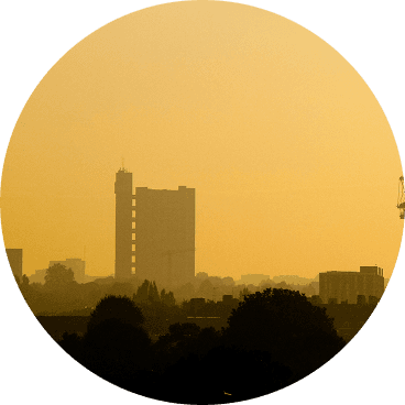
Smoke rides the wind far downwind — you can get smoky air with no fire nearby.
Simple steps to reduce indoor exposure.
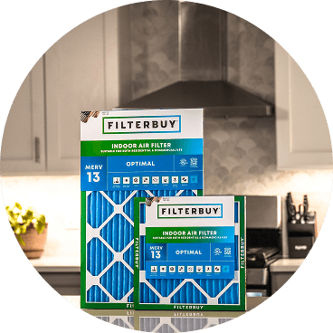
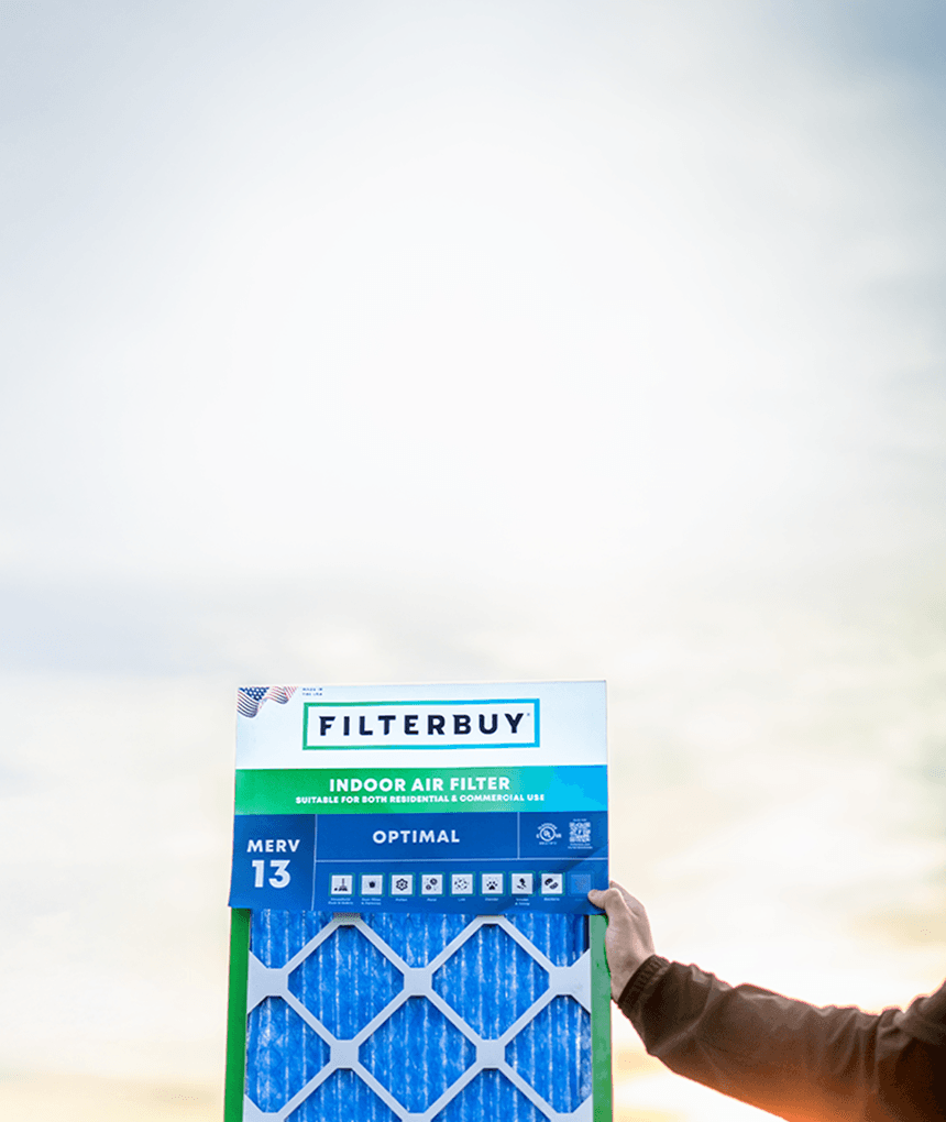
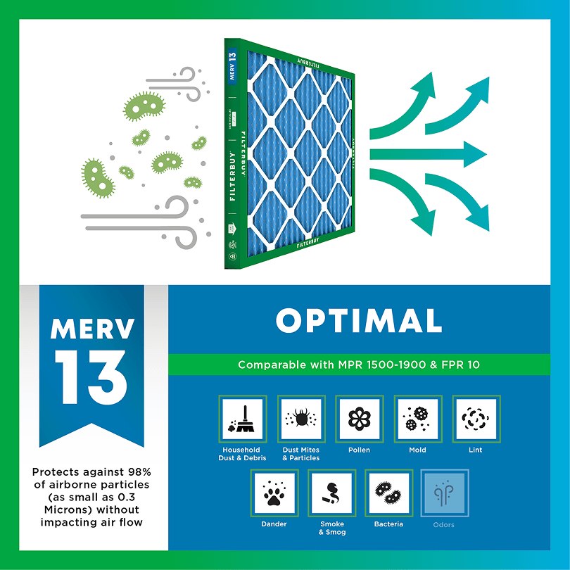
During smoke events, the EPA recommends upgrading to a MERV 13 filter — or the highest-rated filter your system can handle — to help reduce the fine particles smoke brings indoors. MERV 13 is the level most home HVAC systems can run while still capturing PM2.5, the fine particulate that makes up the bulk of wildfire smoke.
Over 70,000 wildfires burn in the U.S. every year.
Wildfire smoke can travel 1,000+ miles, affecting states that aren't even near the blaze.
Exposure to wildfire smoke can worsen asthma, trigger heart issues, and lead to ER visits.
Indoor air can hold more fine particles during wildfire events unless it's properly filtered.
The EPA advises using MERV 13 filters or portable HEPA air cleaners during wildfire smoke events.
Use the live wildfire smoke tracker and upgrade your air filters today to protect your lungs and your home.
Shop Filters For Smoke Protection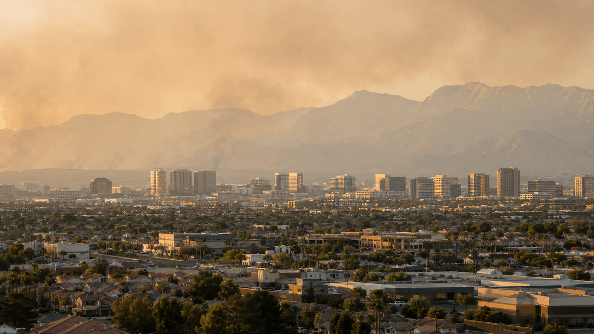
Author: Michelle Wan
Author Page: https://filterbuy.com/author/michelle-wan/
Reviewer: David Clark, Licensed HVAC Technician
Publish Date: July 27, 2026
Updated Date: July 27, 2026
Most wildfire smoke advice online is generic. Ours isn't. Filterbuy manufactures air filters in the U.S. and ships MERV 13 filters to Nevada homes every fire season, and we've watched the same pattern repeat for years: Henderson's air rarely turns bad because a fire is burning nearby. It turns bad because smoke drifts in from somewhere else. This page pairs that pattern with today's live map, plus the steps our customers actually use to keep their air clean.
Henderson's air quality can shift within hours from wildfire smoke drifting in from California and Nevada, plus local dust and traffic pollution along I-11 and Boulder Highway. The live map below tracks fires and smoke in real time. Checking it before outdoor plans and upgrading your filtration before smoke arrives are the two most effective steps a Henderson household can take.
Wildfire smoke can travel hundreds of miles, so Henderson's air can turn unhealthy with no fire nearby.
Southern Nevada sits at normal fire potential for July 2026, but above-normal risk in California and northern Nevada still means more drift smoke here.
The EPA recommends MERV 13, or the highest rating your HVAC system supports, during smoke events.
Children, older adults, pregnant women, and people with asthma, COPD, or heart disease face the highest risk.
A MERV 13 filter with the HVAC fan running continuously can cut indoor PM2.5 by about 50%, per the EPA.
The map above pulls directly from AirNow's national Fire and Smoke Map (see Essential Resources below), the source federal and state agencies use to track fires and drifting plumes. Orange and red shading over Henderson means smoke is degrading local air quality. Gray or hazy overlays mark drift smoke, which traveled in from a distant fire. For a fuller walkthrough of the colors and icons, see Filterbuy’s guide on how to read a wildfire smoke map. Treat this map as a live snapshot, and pair it with the Air Quality Index for current health guidance.
If you're outdoors without the map handy, the Nevada Division of Environmental Protection’s visibility method is a genuine backup. Face away from the sun and pick a fixed landmark at a known distance, like the McCullough Range or Frenchman Mountain. Clear visibility past 10 miles means good air quality. A landmark fading at 3 to 5 miles means unhealthy for sensitive groups. Losing landmarks under 1 mile means hazardous air for everyone.
Henderson sits in the Las Vegas Valley, a basin that traps particle pollution from several sources at once. Desert dust and vehicle emissions along I-11 and Boulder Highway add a year-round baseline, and wildfire smoke layers a second, more volatile source on top that does not need a nearby fire to arrive. Smoke from Southern California and northern Nevada fires regularly drifts in on prevailing winds and can push the local Air Quality Index from green to orange within hours. Track these swings on Henderson's live AQI map.
Nevada's fire season is active, though risk isn't spread evenly. Officials reported roughly 452,500 acres burned across Nevada in 2025, with a similar pattern forecast for 2026 amid extreme drought. The National Interagency Fire Center's July 2026 outlook rates the Great Basin above normal, but excludes southern Nevada, where Henderson sits. Henderson’s own fire risk stays normal even as smoke drifts in from above-normal regions in California and northern Nevada.
Source: U.S. EPA Air Quality Index scale.
Wildfire smoke can affect anyone, but some groups face higher risk meaningfully. The CDC's guidance on wildfire smoke risk names children, older adults, pregnant women, and people with asthma, COPD, heart disease, or diabetes as most likely to experience health effects. Children breathe more air per pound of body weight, raising their exposure risk. The Asthma and Allergy Foundation of America notes that wildfire smoke is a common asthma trigger in summer, and unmanaged exposure can escalate into an ER visit. If anyone in your household falls into one of these groups, check the map above before planning time outdoors.
A few concrete steps make the biggest difference once the map shows smoke.
Stay inside and seal your home. Close windows and doors, and skip activities that add indoor particles, like frying, candles, or vacuuming without a HEPA-rated vacuum.
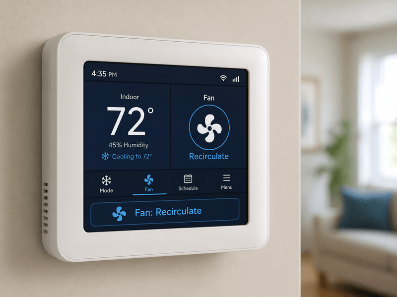
Set your HVAC system to recirculate. This keeps smoke from being drawn into your home at all. Running the fan continuously with a MERV 13 filter can cut indoor PM2.5 by about 50%, per the EPA's guidance on reducing indoor smoke exposure.
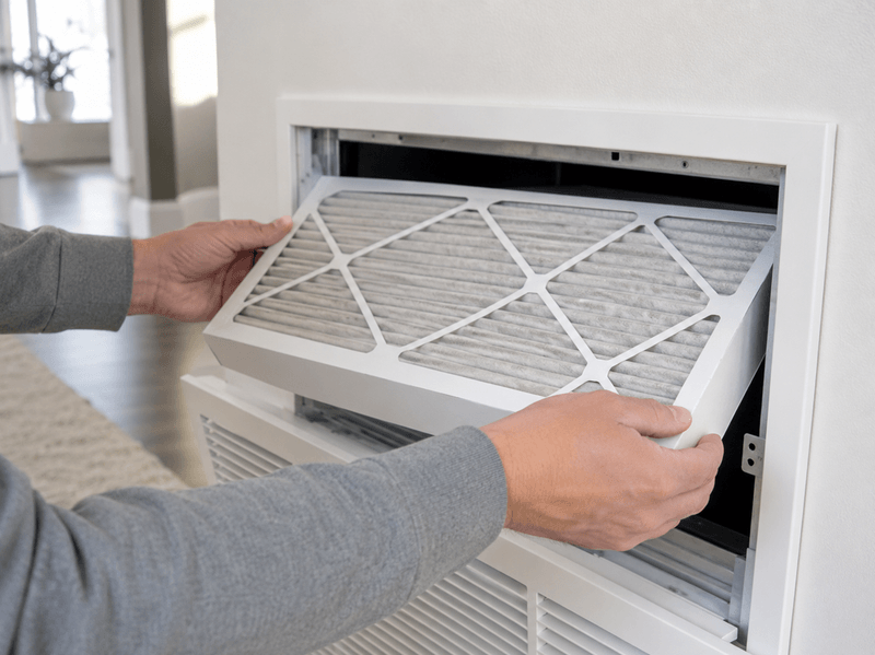
Upgrade your filter before smoke season peaks. The EPA's wildfire smoke and health factsheets recommend MERV 13, or the highest rating your system can run, during smoke events. We see the same thing every season: orders spike right after smoke rolls in, when it is already too late for that event. Not sure which size fits your system? Filterbuy's filter guide and Filterbuy's MERV rating guide cover both in minutes. Shop Filterbuy MERV 13 filters before smoke arrives, not during it.
Wear an N95 respirator outdoors, not a cloth mask. Cloth and surgical masks do not filter fine smoke particles.
Build a clean room for sensitive household members. Seal off one room and run a portable air cleaner or HVAC-fed filtration if the rest cannot stay sealed.
Henderson homeowners often assume smoke problems mean a fire is burning close by, but that’s rarely the case in the valley. After manufacturing filters for over a decade and serving more than two million households, we’ve seen that the households who fare best during a smoke event are the ones who upgraded their filtration before the smoke arrived, not during it.
David Heacock, founder and CEO of Filterbuy
The AirNow Fire and Smoke Map shows live fires, moving smoke plumes, and PM2.5 by ZIP code, a real reading instead of guessing from the haze outside.
Nevada Fire Info tracks active wildfires statewide via a live dashboard and InciWeb reports, answering what the national map cannot: is Nevada actually on fire, and how close.
The National Weather Service's Las Vegas office issues Red Flag Warnings when wind and low humidity raise fire-spread risk, telling you if today's smoke will likely worsen.
Clark County's Office of Emergency Management is the local authority for evacuation orders and alerts across the Las Vegas Valley, the resource that matters most if things escalate.
The CDC's wildfire safety guidance names children, older adults, pregnant women, and people with asthma, COPD, or heart disease as highest risk, so you know how urgently to act.
The EPA's research on wildfire smoke health effects explains why PM2.5 penetrates deep into the lungs, driving respiratory and cardiovascular risk- the science behind every step above.
Ready.gov's wildfire guidance covers go-bags, evacuation routes, and household plans for an active threat, built before you need it, not during a scramble.
A 10 µg/m³ rise in wildfire-specific PM2.5 raises respiratory hospital admissions by 1.3% to 10%.
The same rise from non-wildfire PM2.5 raises admissions by only about 1%.
That makes wildfire smoke up to 10 times more harmful to respiratory health.
Source: Aguilera et al., 2021, Nature Communications
Wildfire smoke (PM2.5) is a documented asthma trigger.
Once AQI passes 100, symptoms, hospital visits, and lung function all worsen.
Source: Asthma and Allergy Foundation of America
An estimated 353,289 residents.
Roughly 132,573 households.
A single smoke event affects a large, still-growing population, not a shrinking one.
Source: U.S. Census Bureau QuickFacts, Henderson city, Nevada
Henderson doesn't need a fire burning in the valley to have a bad air day. Everything on this page comes back to one fact:
Smoke travels farther than most people expect.
The live map shows what's actually in the air right now.
The CDC names who face the highest risk.
The EPA points to MERV 13 as the smoke-season standard.
Filterbuy's take, from years of watching which households handle smoke season well:
The filter matters more than the map.
A live map only tells you smoke has arrived.
By then, the outcome is already decided by whether MERV 13 was in place.
Treating filtration as a fire-season chore, not a smoke-day emergency, keeps homes comfortable no matter what the AQI does.
The map shows active wildfires and drifting smoke plumes in near real time. Orange or red over Henderson means smoke is affecting local air, whether the fire is close or far away.
It can change within a day. Wind can push smoke into the valley by morning and clear it by evening. Check the live map before outdoor plans rather than relying on yesterday's reading.
MERV 13, or the highest rating your HVAC system can safely run, is the EPA’s recommendation for smoke events. True HEPA captures more, but most home systems cannot handle its airflow restriction, so MERV 13 is the practical upgrade.
Children, older adults, pregnant women, outdoor workers, and people with asthma, COPD, heart disease, or diabetes face the highest risk, according to the CDC and EPA.
Check the AQI alongside the map. Orange or higher means sensitive groups should limit outdoor time. Red means everyone should reduce exertion and keep windows closed.
You now know how close wildfire smoke is to Henderson and what to do. Bookmark this page for the next hazy day, and upgrade to a Filterbuy MERV 13 filter now, not once smoke arrives.
AQI (Air Quality Index): A 0-500 EPA scale showing how polluted outdoor air is.
PM2.5: Fine particulate matter 2.5 microns or smaller, the main harmful part of wildfire smoke, since it inhales deep into the lungs.
MERV (Minimum Efficiency Reporting Value): A 1 to 16 scale for HVAC filters, where higher means smaller particles captured.
Fire and Smoke Map: AirNow's national map combining fire locations with real-time smoke plume data.
Red Flag Warning: An NWS alert issued when low humidity and strong wind raise the risk of rapid wildfire spread.
Clean Room: A sealed room, typically with a portable air cleaner, used to keep smoke exposure low.
N95 Respirator: A tight-fitting mask rated to filter 95 percent of airborne particles, unlike cloth or surgical masks.
Subscribe to wildfire smoke alerts for Henderson, NV, to get a heads-up before the next event reaches your area.